| Date: | 1852 |
|---|---|
| Description: | On left side map reads: "Note by the lithographer on the Original Plat there is a Certificate of Record signed by Resister of Dane Co. also a Certificate o... |

| Date: | 1913 |
|---|---|
| Description: | This map shows city wards and government buildings. The map is oriented with north to upper right. |

| Date: | 1917 |
|---|---|
| Description: | Shows property already platted (orange), public property (green), street railway (red lines), Lake Forest development area (red), and some landownership. T... |

| Date: | 1925 |
|---|---|
| Description: | Map produced by the Paul E. Stark Company to advertising sales and services. Bottom of the map features sales records for 1919 to 1925 and a paragraph read... |

| Date: | 1925 |
|---|---|
| Description: | Map produced by the Paul E. Stark Company to advertising sales and services. Bottom of the map features sales records for 1919 to 1925 and a paragraph read... |

| Date: | 1927 |
|---|---|
| Description: | Shows campus buildings, points of interest in surrounding area, and railroads. Advertisements on verso. |

| Date: | 1928 |
|---|---|
| Description: | Illustrated map of points of interest, including University buildings, parks, athletic venues, fraternity and sorority houses, and state buildings. |

| Date: | 1929 |
|---|---|
| Description: | This map is oriented with north to the upper right. Includes index of retailers and buildings, with some advertisements in margins. |

| Date: | 1930 |
|---|---|
| Description: | Lower left hand corner reads: "Compliment of the Madison Association of Commerce MADISON The Four Lake City WISCONSIN." Around the perimeter of the map is ... |

| Date: | 1970 |
|---|---|
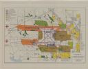
| Description: | Color coded map. Legend in the top left hand corner reads: "EXISTING AIRPORT PAVEMENT" (purple), "FUTURE 5-YEAR DEVELOPMENT" (bright pink), "ULTIMATE AIRPO... |

| Date: | 1974 |
|---|---|
| Description: | A map of Dane County from the Charles Brown Atlas. A hand-drawn blue line marks the Black Hawk Trail. |

| Date: | 1873 |
|---|---|
| Description: | This map shows lots and blocks, additions and subdivisions, and large-scale landownership. The map is oriented with north to the upper right. The map is fr... |

| Date: | 01 08 1959 |
|---|---|
| Description: | Work on the new Tenney Park lock and dam is progressing on schedule. A temporary spillway (not shown) has been built to divert the Yahara River from the co... |

| Date: | 1905 |
|---|---|
| Description: | This map shows roads, railroads, and location of Keyes Springs, now part of Monona. The map reads: "L.S. Smith, c.e., del. May, 1905" and "For further info... |

| Date: | |
|---|---|
| Description: | We've at least been able to conserve something if it's only the idea of conserving for conservation's sake But the community interests ought to come fir... |

| Date: | |
|---|---|
| Description: | A path along railroad tracks on the left and a river on the right. Tall bushes are along the river. Trees and a fence are to the left lining the railroad t... |

| Date: | |
|---|---|
| Description: | Elevated view from hill looking down at a river and reservoir. A railroad train is moving along railroad tracks on the opposite side of the river. Houses a... |

| Date: | |
|---|---|
| Description: | A man and boy stand on a landing in front of two boats with water and a far shoreline in the background. They are holding up their catch of fish. |

| Date: | 1899 |
|---|---|
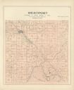
| Description: | A plat map of the township of Westport. |

| Date: | 08 22 1959 |
|---|---|
| Description: | Mayor Ivan Nestingen leads the parade of boats that opened the new Tenney Park lock on Saturday morning. |
If you didn't find the material you searched for, our Library Reference Staff can help.
Call our reference desk at 608-264-6535 or email us at: