 Filter: Categories of Wisconsin Historical Images
Filter: Subject of Railroad tracks
Filter: Reproduction Rights of For Sale
Filter: Year of 1800-1899
Filter: Type of Map or Atlas
Filter: Categories of Wisconsin Historical Images
Filter: Subject of Railroad tracks
Filter: Reproduction Rights of For Sale
Filter: Year of 1800-1899
Filter: Type of Map or Atlas

| Date: | 1873 |
|---|---|
| Description: | Bird's-eye map of La Crosse from the Mississippi River. |

| Date: | 1881 |
|---|---|
| Description: | Bird's-eye map of Milton Junction. |

| Date: | 1878 |
|---|---|
| Description: | Illustrated map of Crawford County. On the bottom right is an inset of a group of people near a train on a railroad track. |

| Date: | 1860 |
|---|---|
| Description: | This colored map shows railroad lines east of the Mississippi as well as in the states bordering the Mississippi River. The Great Lakes and Gulf of Mexico ... |

| Date: | 1855 |
|---|---|
| Description: | Drawn around 1855, this map shows the placement of railroad tracks in southern Wisconsin and northern Illinois connecting Milwaukee, Prairie du Chien, Gale... |

| Date: | 1868 |
|---|---|
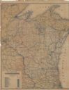
| Description: | Prepared for the State Board of Emigration in 1868, this map shows county boundaries, some cities, and completed and projected railroads. |

| Date: | 1871 |
|---|---|
| Description: | Map of Wisconsin and portions of Minnesota, Michigan, Illinois and Iowa show the major railway tracks and their connections in red and blue ink. Lakes, riv... |

| Date: | 1857 |
|---|---|
| Description: | This hand-colored map shows southern Wisconsin and northern Illinois and indicates county boundaries, larger cities, and some drainage. The line was charte... |

| Date: | 1899 |
|---|---|
| Description: | This map is a folded insert from the pamphlet "Yesterday and Today : A History." The map features the North-Western Line with labeled railway tracks and st... |

| Date: | 1880 |
|---|---|
| Description: | This map covers parts of Minnesota, Iowa, and South Dakota and advertised 1,000,000 acres of land available. Communities, roads, and railroad lines are lab... |

| Date: | 1880 |
|---|---|
| Description: | This map shows wards, roads, railroads, lot and block numbers, subdivisions, parks, and some landownership. A handwritten annotation in red reads: "Note: S... |

| Date: | 1896 |
|---|---|
| Description: | This map shows railroad routes in red, blue, orange, brown, pink, green, and dotted, as well as lakes, rivers, and communities. The map includes a legend i... |
| Date: | 1898 |
|---|---|
| Description: | This map shows railroad routes in red, blue, orange, brown, pink, green, and dotted, as well as lakes, rivers, and communities. The map includes a legend i... |
| Date: | 1850 |
|---|---|
| Description: | This map shows a cross-section of southern Wisconsin, with the Milwaukee and Mississippi Railroad line running from Milwaukee to the Mississippi River near... |

| Date: | 1853 |
|---|---|
| Description: | Map of a cross-section of southern Wisconsin, highlighting the La Crosse Milwaukee Rail Road. Shows canals, railroads, plank and post roads, and township g... |

| Date: | 1854 |
|---|---|
| Description: | This map shows the Manitowoc & Mississippi Railroad line along with other railroad lines in the Great Lakes Region. Lakes Superior, Michigan, Huron, Erie a... |

| Date: | 1855 |
|---|---|
| Description: | This map shows current and purposed railroad routes. Lake Michigan is on the far right, with Lake Superior visible at the top of the map. Routes are marked... |

| Date: | 1856 |
|---|---|
| Description: | This map shows the railroad routes and connection of the Mineral Point Railroad. Lake Michigan is on the far right, while Lake Superior is at the top of th... |

| Date: | 1856 |
|---|---|
| Description: | This map shows the railroad routes that lead to Milwaukee. Included are portions of Minnesota, Iowa and Illinois. Lake Michigan is on the right, while Lake... |
If you didn't find the material you searched for, our Library Reference Staff can help.
Call our reference desk at 608-264-6535 or email us at:
