Map or Atlas
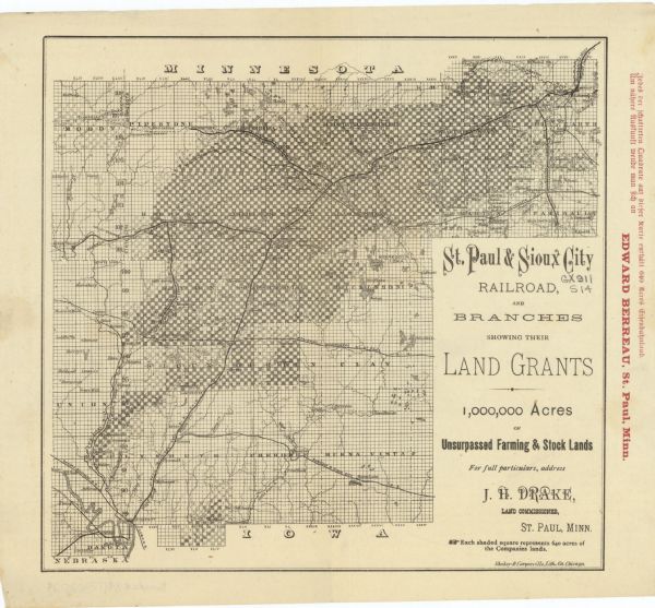
St. Paul and Sioux City Railroad : and Branches, Showing Their Land Grants

| This map covers parts of Minnesota, Iowa, and South Dakota and advertised 1,000,000 acres of land available. Communities, roads, and railroad lines are labeled. The right margin has printing in red ink. |
| Image ID: | 116919 |
|---|---|
| Creation Date: | circa 1880 |
| Creator Name: | St. Paul & Sioux City Railroad Company. |
| City: | |
| County: | |
| State: | |
| Collection Name: | Map Collection |
| Genre: | Map or Atlas |
| Original Format Type: | prints, photomechanical |
| Original Format Number: | H GX911 S14 |
| Original Dimensions: | 20 x 21 cm. |
| Cities and towns |
| Real estate development |
| Railroad tracks |
| Railroads |
| Roads |
| Lakes |
| Rivers |
| This image is issued by the Wisconsin Historical Society. Use of the image requires written permission from the staff of the Collections Division. It may not be sold or redistributed, copied or distributed as a photograph, electronic file, or any other media. The image should not be significantly altered through conventional or electronic means. Images altered beyond standard cropping and resizing require further negotiation with a staff member. The user is responsible for all issues of copyright. Please Credit: Wisconsin Historical Society. |
| Location: | Wisconsin Historical Society Archives, 4th Floor, Madison, Wisconsin |
|---|
