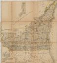
| Date: | 1849 |
|---|---|
| Description: | Published in Germany a year after Wisconsin entered statehood, this map shows prairies, swamps, lakes, mounds, limestone deposits, and lead and copper mine... |

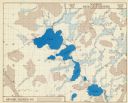
| Date: | 1974 |
|---|---|
| Description: | This 1974 map is a reproduction of the original survey maps of the Four Lakes region of Dane County, Wisconsin. It shows sections, lakes, rivers, wetlands,... |

| Date: | 1840 |
|---|---|
| Description: | This manuscript map by Increase Lapham shows the railroads, roads, wetlands, lakes and streams, dams, prairies, and settlers in the eastern half of Waukesh... |

| Date: | 1720 |
|---|---|
| Description: | Detailed, ornate, and comprehensive map of America from the east coast to present day Texas. Numerous features appear throughout the map, including Native ... |
If you didn't find the material you searched for, our Library Reference Staff can help.
Call our reference desk at 608-264-6535 or email us at: