 Filter: Categories of Wisconsin Historical Images
Filter: Subject of Postal service
Filter: Type of Map or Atlas
Filter: Categories of Wisconsin Historical Images
Filter: Subject of Postal service
Filter: Type of Map or Atlas

| Date: | 1894 |
|---|---|
| Description: | This map shows railroads, street railways, roads, wards, block numbers, parks, Lake Michigan, and one mile concentric circles indicating distance from the ... |

| Date: | 1860 |
|---|---|
| Description: | This map shows roads, trails, and railroads throughout Nebraska, Arkansas, Missouri, Kansas, Illinois, and Utah, including the Salt Lake City & California ... |

| Date: | 1857 |
|---|---|
| Description: | This map shows the railroad routes of the Milwaukee & Horicon Railroad, common roads, counties, canals, townships, cities, county towns, villages, post off... |

| Date: | 1905 |
|---|---|
| Description: | This photocopied map shows landownership, roads, railroads, rural mail routes, churches, school houses, cemeteries, and townships. The map includes adverti... |

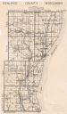
| Date: | 1900 |
|---|---|
| Description: | This map shows landownership, railroads, roads, churches, schools, cemeteries, post offices, townships, city wards, Lake Michigan, and rivers. The map incl... |
| Date: | 1913 |
|---|---|
| Description: | This map shows landownership, rural mail routes, rural buildings, railroads, U.S. national highways, state trunk highways, county trunk highways, township... |

| Date: | 1902 |
|---|---|
| Description: | This map shows townships, land parcels, schools, rivers, lakes, creameries, churches, cemeteries, roads, post offices, town halls, saw mills, roads and sto... |

| Date: | 1915 |
|---|---|
| Description: | This map shows roads, railroads, street railways, abandoned logging railroads, rural mail routes, telephone lines, schools, platted land, and state forest ... |

| Date: | 1720 |
|---|---|
| Description: | One of Herman Moll's most famous maps, often referred to as The Beaver Map for its elaborate engraved inset depicting and describing beavers building a dam... |

| Date: | 1871 |
|---|---|
| Description: | This maps shows the entire state with an inset map in the lower left corner of Milwaukee. Railroads, roads, canals, the state capital, towns, cities, towns... |

| Date: | 1767 |
|---|---|
| Description: | Map of the north east coast of America, showing colonial borders, cities, Native American land, lakes, rivers, and a few hills and mountains. Illustrated t... |

| Date: | 1780 |
|---|---|
| Description: | Detailed map of America east of the Louisiana region. It shows forts, cities, borders and boundary lines, Native American land, the post road, mountains, w... |

| Date: | 06 26 1919 |
|---|---|
| Description: | Map outlining Alfred Lawson's plan for airmail delivery routes across the United States, including several stops in Wisconsin. The accompanying text reads:... |

| Date: | 1901 |
|---|---|
| Description: | A plat map of Marathon county, township 29, north range, 8 east. |

| Date: | 1908 |
|---|---|
| Description: | A Sanborn fire map of Brodhead. Includes an inset at top right showing distances from P.O. |
If you didn't find the material you searched for, our Library Reference Staff can help.
Call our reference desk at 608-264-6535 or email us at:

