 Filter: Categories of Wisconsin Historical Images
Filter: Subject of Parks
Filter: Type of Map or Atlas
Filter: Categories of Wisconsin Historical Images
Filter: Subject of Parks
Filter: Type of Map or Atlas

| Date: | 1930 |
|---|---|
| Description: | This map shows city wards, streets, railroads, parks, Lake Butte Des Morts, Lake Winnebago, advertisements for Dixie Oils Gasoline, a list of Cook & Brown ... |

| Date: | 1956 |
|---|---|
| Description: | This map shows Lake Wisconsin, roads, highways, parks, resort areas, camps, gardens, and Wisconsin State experimental game and fur farm. The back of the ma... |

| Date: | 1935 |
|---|---|
| Description: | This map includes an index on the right margin of industrial plants, churches, schools, and public buildings. Streets, the Rock River, Lake Michigan, parks... |

| Date: | 1934 |
|---|---|
| Description: | This map is attached to a cover. Streets, points of interest, the Milwaukee River, and Lake Michigan are labeled. The bottom margin of the map includes a s... |

| Date: | 01 1856 |
|---|---|
| Description: | This map shows lots, lots appropriated for churches and schools, streets, parks, court house, and land to be appropriated for railroad depots. An inset map... |

| Date: | 1900 |
|---|---|
| Description: | This map shows streets, railroads, dock and harbor lines, and parks. The map includes population tables for 1880, 1890, 1900. |

| Date: | 1858 |
|---|---|
| Description: | This map shows lot and block numbers, landownership, buildings, railroads, roads, wards, points of interest, parks, and cemeteries. Also included are illus... |

| Date: | 01 18 1907 |
|---|---|
| Description: | This map shows Lake Michigan, streets, schools, churches, businesses, cemeteries, parks, and railroads. Relief is shown by contours; depths are shown by so... |

| Date: | 1986 |
|---|---|
| Description: | Pictorial map showing businesses with phone numbers, roads, railroads, and parks. Includes text titled: "History of Portage County." |

| Date: | 1893 |
|---|---|
| Description: | This map shows wards, railroads, street cars, streets, lot and block numbers, landownership, parks, hospitals, the Sheboygan River, and Lake Michigan. Ward... |

| Date: | 1921 |
|---|---|
| Description: | This map shows Lake Michigan, the Sheboygan River, buildings, streets, churches, industrial yards, and parks. Relief is shown by hachures and depths are sh... |

| Date: | 1890 |
|---|---|
| Description: | This map shows lot and block numbers and dimensions, landownership, city wards, buildings, streets, railroads, parks, cemeteries, churches, schools, and in... |

| Date: | 1915 |
|---|---|
| Description: | This map shows wards, railroads, street railways, streets, lot and block numbers, parks, and hospitals. Also included are manuscript annotations of points ... |

| Date: | 1899 |
|---|---|
| Description: | This map is ink on tracing cloth and shows lot and block numbers and dimensions, streets, the high school park, and survey monuments. The map is oriented ... |

| Date: | 1891 |
|---|---|
| Description: | This hand-colored map shows platted additions and subdivisions, ward boundaries, schools, churches, railroads, cemeteries, parks, businesses, factories, an... |

| Date: | 1956 |
|---|---|
| Description: | This map shows local streets, roads, railroads, highways, parks, cemeteries, hospitals, the University of Wisconsin, Middleton, Maple Bluff, Shorewood Hill... |

| Date: | 1968 |
|---|---|
| Description: | Three maps that show local streets, roads, railroads, parks, country clubs, the University of Wisconsin, Shorewood Hills, Maple Bluff, Monona, Truax Field,... |

| Date: | 1971 |
|---|---|
| Description: | This map shows streets, highways, railroads, parks, colleges, cemeteries, county clubs, University of Wisconsin, Truax Field, Middleton, Shorewood Hills, M... |
| Date: | |
|---|---|
| Description: | This map is a photocopy and shows the Oconomowoc River, Flower Lake, lot and block numbers and dimensions, additions, streets, C.M.St.P.&P. Ry., T.M.E.R.&L... |

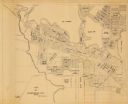
| Date: | 1923 |
|---|---|
| Description: | Map showing the parcel of land on the shore of Lake Monona acquired by the City of Madison for a park (today known as Olbrich Park). |
If you didn't find the material you searched for, our Library Reference Staff can help.
Call our reference desk at 608-264-6535 or email us at: