 Filter: Categories of Wisconsin Historical Images
Filter: Subject of Ocean
Filter: Subject of land use, urban
Filter: Categories of Wisconsin Historical Images
Filter: Subject of Ocean
Filter: Subject of land use, urban
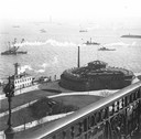
| Date: | 1900 |
|---|---|
| Description: | Elevated view, probably early 20th century New York Harbor. |

| Date: | 1715 |
|---|---|
| Description: | A map of the countries and islands surrounding the Gulf of Mexico. The hand-colored borders separate the territories of England, France, Spain, and Holland... |
If you didn't find the material you searched for, our Library Reference Staff can help.
Call our reference desk at 608-264-6535 or email us at: