| Date: | |
|---|---|
| Description: | View of a ship in the spring on the edge of the ice five miles off Nome. On shore, sleds and sled dogs are in the foreground. Caption reads: "The first boa... |

| Date: | |
|---|---|
| Description: | A group of men, women, and children fishing from a rock outcrop along the pacific coast. Caption reads: "Fishing Rocks, Near Seaview, Wash." |

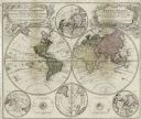
| Date: | 1746 |
|---|---|
| Description: | This world map from the German mathematician, historian, and geographer Johann Matthias Hase shows the major cities, islands, and the major political divis... |

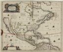
| Date: | 1636 |
|---|---|
| Description: | Map of North America, divided into regions, and showing some rivers, lakes, settlements, cities, mountains, and Native American land. Of the Great Lakes on... |
If you didn't find the material you searched for, our Library Reference Staff can help.
Call our reference desk at 608-264-6535 or email us at: