 Filter: Categories of Wisconsin Historical Images
Filter: Subject of Mississippi River
Filter: Year of 1800-1899
Filter: Categories of Wisconsin Historical Images
Filter: Subject of Mississippi River
Filter: Year of 1800-1899

| Date: | 1857 |
|---|---|
| Description: | This map shows section corners, quarter section corners, foundry, steam saw mill, steam grist mill, planning mill, court house, baptist church, congregatio... |

| Date: | 1895 |
|---|---|
| Description: | Elevated view from bluffs, looking north-east toward Lake City, Minnesota and Lake Pepin of the Mississippi River. |

| Date: | 1899 |
|---|---|
| Description: | This map is a folded insert from the pamphlet "Yesterday and Today : A History." The map features the North-Western Line with labeled railway tracks and st... |

| Date: | 1890 |
|---|---|
| Description: | This map features township outlines, railroads, roads, post offices, and landownership for La Crosse County. Various communities appear in yellow, green, a... |

| Date: | 1882 |
|---|---|
| Description: | This map is ink on cardboard and shows the location of military forts over the course of years. Also shown are points of interest, streets, the Mississippi... |

| Date: | 1800 |
|---|---|
| Description: | This map is ink and watercolor on paper and shows the main channel and sand bars in the Mississippi River between villages. |

| Date: | 1882 |
|---|---|
| Description: | This map is ink and watercolor on paper and shows numbered plots, the public square, streets, Lake St. Croix and the Mississippi River. |

| Date: | 1883 |
|---|---|
| Description: | This map shows ward boundaries, names of additions, streets, bridges, mills, schools, religious buildings, businesses, hotels, railroads, factories, brewer... |

| Date: | 1838 |
|---|---|
| Description: | This map is a development plat that shows street names, numbered blocks and lots, and small farm lot owners. Included on the right of the map is a large am... |

| Date: | 06 1853 |
|---|---|
| Description: | This map is ink, pencil, and color on paper and shows lot and block numbers and dimensions, sold lots, streets, and the Mississippi River. Some lots are co... |

| Date: | 1856 |
|---|---|
| Description: | This map shows lot and block numbers, streets, the Mississippi River, Fort Crawford, depot ground, and a graveyard. An old fort location is outlined in red... |

| Date: | 12 05 1854 |
|---|---|
| Description: | This plat map shows landowners, the Mississippi River, the Marais de St. Friole, and an old fort. The left margin reads: "Part of the Main Village of Prair... |

| Date: | 1828 |
|---|---|
| Description: | This plat map is pen-and-ink and shows landowners, the Mississippi River, the Marais de St. Friole, Fort Crawford, the town commons, and the Village of St.... |

| Date: | 1828 |
|---|---|
| Description: | This map is pen-and-ink and served as the model for the lithograph produced in 1828 by C.B. Graham. Landowners are labeled as is the Mississippi River. |

| Date: | 1891 |
|---|---|
| Description: | This hand-colored map shows platted additions and subdivisions, ward boundaries, schools, churches, railroads, cemeteries, parks, businesses, factories, an... |

| Date: | 1839 |
|---|---|
| Description: | This map, one of a series made by Thomas Jefferson Cram of the U.S. Topographical Engineers from personal surveys, covers the area from Green Bay to the ju... |

| Date: | 1846 |
|---|---|
| Description: | This map shows rivers, lakes, and towns in states west of the Mississippi River. Lake Michigan, Lake Superior, and Green Bay are labeled. Some areas are ou... |
| Date: | 1834 |
|---|---|
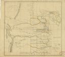
| Description: | This map shows the locations of Indian tribes, and lands sold and ceded, as well as roads, forts, and rivers. Lands in the Great Plains are covered, and Ar... |

| Date: | 1837 |
|---|---|
| Description: | This map shows the planned military posts/depots, roads, existing forts, rivers, and land assigned to various Indian tribes. Illinois, Mississippi, Arkansa... |

| Date: | 1837 |
|---|---|
| Description: | This map shows planned military posts/depots, barracks, rivers, lakes, roads, existing forts, and land assigned to various Indian tribes. Arkansas, Illinoi... |
If you didn't find the material you searched for, our Library Reference Staff can help.
Call our reference desk at 608-264-6535 or email us at: