| Date: | 1814 |
|---|---|
| Description: | Map of the Upper Territories of the United States. |

| Date: | 1835 |
|---|---|
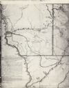
| Description: | Constructed for the Topographical Bureau [Wash.], 1835. Scale: 16 miles to 1 inch. Map of a portion of the Indian country lying east and west of the Missis... |

| Date: | 1900 |
|---|---|
| Description: | A map of Wisconsin, eastern Minnesota and Iowa, northern Iowa, and Michigan’s Upper Peninsula, showing railway lines, with those marked with heavy red line... |

| Date: | 1874 |
|---|---|
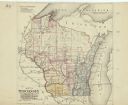
| Description: | A hand-colored, geological map of Wisconsin show the progress of the state geological survey in 1873 and 1874. Other elements displayed in the map include... |

| Date: | 1899 |
|---|---|
| Description: | This map is a folded insert from the pamphlet "Yesterday and Today : A History." The map features the North-Western Line with labeled railway tracks and st... |

| Date: | 1851 |
|---|---|
| Description: | This map shows labeled counties in Wisconsin and unlabeled county in Michigan. It includes Door County, which was established 1851, but lacks Kewaunee Coun... |

| Date: | 1853 |
|---|---|
| Description: | This facsimile map shows counties, towns, and waterways in the state of Wisconsin. Included are portions of Iowa, Michigan, and Minnesota. Lake Superior an... |

| Date: | 1829 |
|---|---|
| Description: | This map shows waterways, trails, settlements, Indian villages, and boundaries. The map includes text in the lower left with excerpts from Indian land trea... |

| Date: | 1910 |
|---|---|
| Description: | This map shows the Soo Line railroad and Arpin Hardwood Lumber Company lands in red. The top margin of the map reads: "Wisconsin, the safest state in the U... |

| Date: | 1868 |
|---|---|
| Description: | This map includes a table of estimated costs "by Brev. Maj. Gen. G.K. Warren Maj. U.S.E., of improvement of Wis. River from his survey of 1867." Included a... |

| Date: | 1720 |
|---|---|
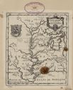
| Description: | Map showing the course of the Mississippi River from the Gulf of Mexico up past Lake Superior into Canada. It shows the towns, Native American tribes and l... |

| Date: | 1755 |
|---|---|
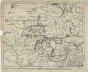
| Description: | Map of the Great Lakes region during the French and Indian War. It shows in great detail the territories, borders and boundary lines, Native American tribe... |
If you didn't find the material you searched for, our Library Reference Staff can help.
Call our reference desk at 608-264-6535 or email us at: