 Filter: Categories of Wisconsin Historical Images
Filter: Subject of Michigan, Lake
Filter: Community of Milwaukee
Filter: Categories of Wisconsin Historical Images
Filter: Subject of Michigan, Lake
Filter: Community of Milwaukee

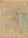
| Date: | 1863 |
|---|---|
| Description: | Includes index to public buildings, churches, schools. Inset: Glidden & Lockwood’s addition. Gives names of some property owners. |

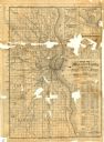
| Date: | 1869 |
|---|---|
| Description: | This map was engraved from original drawings and surveys taken by Louis Lipman. Includes Milwaukee street directory on the left hand side. Bottom right cor... |

| Date: | 1877 |
|---|---|
| Description: | Two maps on one page, removed from an atlas. The first map shows Wisconsin and the upper peninsula of Michigan counties and townships while the second map ... |

| Date: | 1880 |
|---|---|
| Description: | Map created from original drawing and surveys taken by Silas Chapman. Bottom right corner features a reference key. There is a street guide on the left sid... |
| Date: | 1886 |
|---|---|
| Description: | The map reads: "Compiled under the direction of the J.V. DUPRE ABSTRACT CO. from Dupre’s 1/4 Sectn’l Atlas of Milwaukee, by G. Steinhagen, C.E." The map co... |
| Date: | 1886 |
|---|---|
| Description: | Two maps on one page. The first page is a map of Milwaukee County with insets "Plan of Pewaukee, Waukesha Co.," "Plan of Oconomowoc, Waukesha Co.," "Plan o... |

| Date: | 1888 |
|---|---|
| Description: | Map of Milwaukee "Compiled under the direction of the J.V. DUPRE ABSTRACT CO., from Dupre’s 1/4-Sectn’l Atlas of Milwaukee, by G. Steinhagen, C.E." Contain... |

| Date: | 1889 |
|---|---|
| Description: | Bird’s-eye-view map. Published in the Milwaukee Sentinel: Wednesday morning, August 28, 1889 for the 23rd National Encampments of the GAR, August 27... |

| Date: | 1891 |
|---|---|
| Description: | This maps has an index of depots, hotels, prominent institutions and buildings, churches, and places of amusement. The map was removed from an unidentified... |

| Date: | 1896 |
|---|---|
| Description: | Map highlighting parks and other points of interest in Milwaukee. |

| Date: | 1902 |
|---|---|
| Description: | Map reads: "Milwaukee's Polish Population. Map showing in Red Color the Location and Density of Polish=Speaking Population of the City of Milwaukee, Wis." ... |

| Date: | 1911 |
|---|---|
| Description: | Map printed in the Milwaukee Herald, 16th of February, 1912. Includes list of Assembly, State Senate, and Congressional districts in bottom margin. Contain... |

| Date: | 1931 |
|---|---|
| Description: | This map is an advertisement for Milwaukee street cars and motor buses and reads: "Ride the street car or motor bus. Economical, safe, dependable." Include... |

| Date: | 1934 |
|---|---|
| Description: | Map showing the ward boundaries of Milwaukee. Each ward is numbered and boundary streets are labelled. The bottom right corner reads: "CITY ENGINEER'S DEPT... |

| Date: | 1950 |
|---|---|
| Description: | This map is accompanied by booklet: "Know Milwaukee Map and Street Guide". The map is a detailed map of Milwaukee and the surrounding suburbs. Streets and ... |

| Date: | 1940 |
|---|---|
| Description: | This map is pen and ink on paper and is 1 map consisting of 12 sheets. This map includes a numbered key labeling each area, all of which are represented ... |

| Date: | 1840 |
|---|---|
| Description: | Pen-and-ink on paper. Map shows 1840’s homes with owner names, a Native American cemetery, and other points of interest. Relief shown by hachures. Oriented... |

| Date: | 1940 |
|---|---|
| Description: | Shows Milwaukee and Waukesha counties, and parts of Dodge, Washington, Ozaukee, Jefferson, Walworth, and Racine counties. Includes indexes of "Cities, Town... |

| Date: | 1927 |
|---|---|
| Description: | Street railway and motor bus map with a legend of "Street Car Line," "Auxiliary Bus Lines," and "Motor Bus Lines." The routes are numbered. The map reads: ... |

| Date: | 1800 |
|---|---|
| Description: | Map of additions to Milwaukee. Several of the additions are outlined in colors and many streets, waterways, and some landmarks are labelled. |
If you didn't find the material you searched for, our Library Reference Staff can help.
Call our reference desk at 608-264-6535 or email us at: