 Filter: Categories of Wisconsin Historical Images
Filter: Subject of Marshes
Filter: Subject of human settlements
Filter: Categories of Wisconsin Historical Images
Filter: Subject of Marshes
Filter: Subject of human settlements

| Date: | 1857 |
|---|---|
| Description: | This map depicts the township survey grid in Wisconsin and northern Michigan and identifies counties, named towns, cities and villages, rivers, lakes, rail... |

| Date: | 1858 |
|---|---|
| Description: | This map shows the township survey grid and identifies counties, named towns, cities and villages, rivers, lakes, and railroads and proposed railroads in W... |

| Date: | 1858 |
|---|---|
| Description: | This map of the entire state of Wisconsin depicts the township survey grid and identifies counties, named towns, cities and villages, rivers, lakes, railro... |

| Date: | 1859 |
|---|---|
| Description: | This map of the entire state of Wisconsin depicts the township survey grid and identifies counties, named towns, cities and villages, rivers, lakes, railro... |

| Date: | 1861 |
|---|---|
| Description: | This map of the entire state of Wisconsin depicts the township survey grid and identifies counties, named towns, cities and villages, rivers, lakes, railro... |

| Date: | 1864 |
|---|---|
| Description: | This map of the entire state of Wisconsin depicts the township survey grid and identifies counties, named towns, cities and villages, rivers, lakes, railro... |

| Date: | 1865 |
|---|---|
| Description: | This map of the entire state of Wisconsin depicts the township survey grid and identifies counties, named towns, cities and villages, rivers, lakes, railro... |

| Date: | 1871 |
|---|---|
| Description: | This map of Wisconsin and surrounding states depicts the township survey grid and identifies counties, named towns, cities and villages, rivers, lakes, rai... |

| Date: | 1874 |
|---|---|
| Description: | This hand-colored map shows the railroads "completed" "in progress" and "contemplated" rivers, counties, cities and villages, and named towns in the state,... |

| Date: | 1874 |
|---|---|
| Description: | This hand-colored map of Wisconsin and the western portion of Michigan's Upper Peninsula, shows the township grid, railroads completed and in progress, cou... |

| Date: | 1878 |
|---|---|
| Description: | A hand-colored map of Wisconsin and the western portion of Michigan’s Upper Peninsula, showing the railroads that are completed and in progress, counties, ... |

| Date: | 1881 |
|---|---|
| Description: | A hand-colored, cloth mounted, sectional map of Wisconsin showing the township grid, completed and proposed railroads, counties, towns, cities, villages. T... |

| Date: | 1873 |
|---|---|
| Description: | A map that covers parts of Winona and Houston Counties, Minnesota and La Crosse County, Wisconsin, showing the proposed railroad routes, constructed rail l... |

| Date: | |
|---|---|
| Description: | A map of the Wisconsin counties of Lincoln, Oneida, Vilas, parts of Iron, Price & Langlade that shows the township and range grid, sections, villages, rai... |

| Date: | 1858 |
|---|---|
| Description: | This 1858 map of Racine County, Wisconsin, shows land ownership and acreages, the township and range grid, towns, cities and villages, roads, railroads, sc... |

| Date: | 1914 |
|---|---|
| Description: | This early 20th century map shows the township and range system, sections, railroads, roads, lakes, wetlands, and streams in the western Sawyer County town... |

| Date: | 1890 |
|---|---|
| Description: | This manuscript map of Township 16 North, Range 6 West, 4th Principal Meridian, encompasses the Town of Barre and the southern portion of the Town of Hamil... |

| Date: | 1890 |
|---|---|
| Description: | This late 19th century map shows sections, state lands, Barre Center P.O. (now Barre Mills), railroads, topography, and streams and wetlands in the Town of... |

| Date: | 1896 |
|---|---|
| Description: | This late 19th-century map of Dodge County, Wisconsin, shows the township and range grid, towns, sections, cities, villages and post offices, some property... |
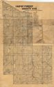
| Date: | 1908 |
|---|---|
| Description: | Map shows swamps, windfalls, roads and railroads. Status of some land marked (O, S, X) but lacks explanation. |
If you didn't find the material you searched for, our Library Reference Staff can help.
Call our reference desk at 608-264-6535 or email us at: