Visit our other Wisconsin Historical Society websites!
 Filter: Categories of Wisconsin Historical Images
Filter: Subject of Maps
Filter: Categories of Wisconsin Historical Images
Filter: Subject of Maps
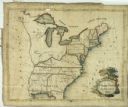
| Date: | 1809 |
|---|---|
| Description: | Embroidered sampler of a map of the United States. |
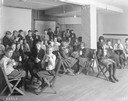
| Date: | 1921 |
|---|---|
| Description: | Classroom full of school children drinking milk at Washington school. |
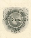
| Date: | 1907 |
|---|---|
| Description: | Illustration from an International Harvester McCormick line catalog showing the McCormick name in script superimposed over a globe of the earth. |
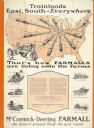
| Date: | 1928 |
|---|---|
| Description: | Advertising poster for McCormick-Deering Farmall tractors showing a map of the United States with trains speeding in all directions from Illinois. Bears th... |
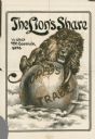
| Date: | 1900 |
|---|---|
| Description: | Print advertisement for the McCormick Harvesting Machine Company showing a giant Lion with its claws on a globe of the earth. The earth bears the words "Wo... |

| Date: | 07 1838 |
|---|---|
| Description: | A map diagram of Indian effigy mounds seven miles east of Blue Mounds in the Wisconsin Territory. |
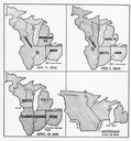
| Date: | 01 11 1805 |
|---|---|
| Description: | Four map illustrations showing the political subdivisions of the Northwest Territory from 1805 through 1834. |
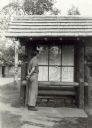
| Date: | 1939 |
|---|---|
| Description: | Man looking at a map of Copper Falls State Park, which is on display to assist visitors. |

| Date: | 1926 |
|---|---|
| Description: | Pages 21 and 22 from the 1926 schedule are a map showing the routes of the Goodrich Transit Company, Great Lakes Transit Company, Detroit and Cleveland Lin... |
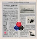
| Date: | 1930 |
|---|---|
| Description: | Page 4 from the schedule describes the trip from Chicago, Illinois, to Milwaukee, Wisconsin, on the "Christopher Columbus" or "Theodore Roosevelt". Include... |

| Date: | 1930 |
|---|---|
| Description: | Page 8 of the 1930 schedule is a map of the routes of the Goodrich Steamship Lines in Lake Michigan and Lake Huron. |

| Date: | 1780 |
|---|---|
| Description: | Hand-drawn plan for the layout of the town of Clarksville, bordering Mayfield Creek and Liberty Creek. Fort Jefferson is shown between the townsite and the... |

| Date: | 1780 |
|---|---|
| Description: | Plan for layout of 150,00 acres which make up Clark's Illinois Grant. |
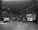
| Date: | 02 07 1929 |
|---|---|
| Description: | Showroom featuring the Special Delivery truck (center) that crossed the Sahara Desert from 1927-1928. There is a framed map on an easel on the left. |
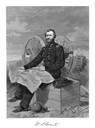
| Date: | |
|---|---|
| Description: | An engraving from a photograph of Ulysses S. Grant wearing a military uniform. He is seated in front of a cannon with a map unfolded in his lap, and cannon... |
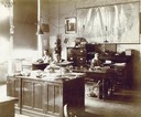
| Date: | 08 1909 |
|---|---|
| Description: | Three office workers at their desks at an International Harvester office in Canada(?). A map of Canada and a portrait of William Deering are hanging on the... |
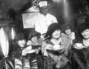
| Date: | |
|---|---|
| Description: | A tea party on an airplane, a publicity stunt conceived by Harry Bruno to promote his Cleveland-area airline, Aeromarine Airlines. By taking local reporter... |
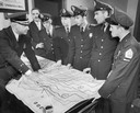
| Date: | 11 21 1956 |
|---|---|
| Description: | Uniformed police officers looking over a laid out map with potential escape routes. |
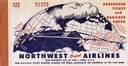
| Date: | 1948 |
|---|---|
| Description: | Passenger ticket and baggage check for Northwest Orient Airlines, illustrating their newly initiated around-the-globe routes to the Far East. This ticket w... |
If you didn't find the material you searched for, our Library Reference Staff can help.
Call our reference desk at 608-264-6535 or email us at:
