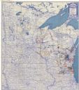
| Date: | 1929 |
|---|---|
| Description: | This map shows the entire state of Wisconsin and Minnesota and portions of Illinois and Iowa. Counties, cities, highways, lakes, and rivers are labeled. Ro... |

| Date: | 1990 |
|---|---|
| Description: | This map, in addition to the Fort ground and buildings, shows owners of outbuildings, heights of buildings in stories, fences, roads, gardens, and cemetery... |

| Date: | 1966 |
|---|---|
| Description: | This blue line print shows existing and proposed streets, docks, company-owned land, railroads and railroad yards, parks, and municipal airport. |

| Date: | 06 26 1919 |
|---|---|
| Description: | Map outlining Alfred Lawson's plan for airmail delivery routes across the United States, including several stops in Wisconsin. The accompanying text reads:... |
If you didn't find the material you searched for, our Library Reference Staff can help.
Call our reference desk at 608-264-6535 or email us at: