 Filter: Categories of Wisconsin Historical Images
Filter: Subject of Maps
Filter: Subject of cities and towns
Filter: Categories of Wisconsin Historical Images
Filter: Subject of Maps
Filter: Subject of cities and towns
| Date: | |
|---|---|
| Description: | Drawn map of Landsford, South Carolina, from Thomas Sumter Papers. |
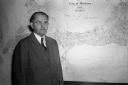
| Date: | 11 10 1944 |
|---|---|
| Description: | Mayor F. Halsey Kraege standing in front of a 1930 City of Madison map. |

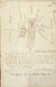
| Date: | 12 26 1862 |
|---|---|
| Description: | Handsketched map of the area around Knobs Gap. |

| Date: | 1829 |
|---|---|
| Description: | Map of lead mines operating in Wisconsin. |

| Date: | 1855 |
|---|---|
| Description: | Fox-Wisconsin portage and canal map, when the canal was not yet built. From a map in the office of the city clerk at Portage. "The old trail, the location ... |

| Date: | 1862 |
|---|---|
| Description: | Birds-eye view of a Wisconsin Civil War regiment on parade in Fond du Lac, as drawn by Louis Kurz from the Marr Street Methodist Church. The regiment canno... |
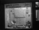
| Date: | 03 17 1947 |
|---|---|
| Description: | Wisconsin Felton Sporting Goods window display of state map and pairings chart for 1947 State Basketball Tournament. "Welcome State Tournament Fans." |
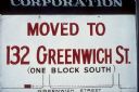
| Date: | 1969 |
|---|---|
| Description: | A sign reads that a business has "Moved to 132 Greenwich St. (one block south)." Along with the written description, there is a small map to show where the... |

| Date: | 1837 |
|---|---|
| Description: | Copy of N.F. Hyer's original map of Aztalan as published in the Milwaukee Advertiser, February 25, 1837. |
| Date: | |
|---|---|
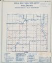
| Description: | Rural electrification survey map of Marquette county in Westfield township. |
| Date: | |
|---|---|
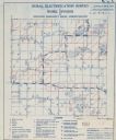
| Description: | Rural electrification survey map of Waushara county in Springwater township. |

| Date: | 1959 |
|---|---|
| Description: | University of Wisconsin-Madison campus. Numbers in circles identify buildings across campus with the building index. Black arrows point out important infor... |
| Date: | 08 1861 |
|---|---|
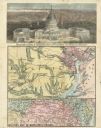
| Description: | Large-format, illustrated stationery purchased by Rudolph Fine, a member of the 6th Wisconsin Infantry in August, 1861, showing the Capitol (in actuality, ... |
| Date: | 1979 |
|---|---|
| Description: | Map for location of the Magic Picnic, a celebration of the lesbian and gay community, which took place in Brittingham Park. |
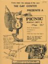
| Date: | 1979 |
|---|---|
| Description: | Poster for picnic presented by the Gay Center at Vilas Park. Includes an image of a fox and telephone. |

| Date: | 1930 |
|---|---|
| Description: | Exterior view of the Triangle filling station on Highway 12, which sold gasoline, ice, and other items. A man stands in front by the gas pump, and a map of... |
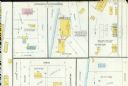
| Date: | 03 1904 |
|---|---|
| Description: | Detail of a Sanborn map of Grafton including the Sheboygan Knitting Company. |
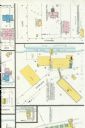
| Date: | 07 1929 |
|---|---|
| Description: | A detail of a Sanborn map of Grafton including the New York Recording Laboratory. |
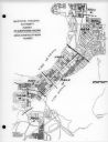
| Date: | 03 16 1950 |
|---|---|
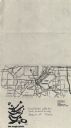
| Description: | Map of areas surveyed by block number as part of the Madison Housing Authority Survey of Substandard Housing. |
If you didn't find the material you searched for, our Library Reference Staff can help.
Call our reference desk at 608-264-6535 or email us at:
