| Date: | 09 1894 |
|---|---|
| Description: | This map shows Congregational churches and Home Missionary churches. County boundaries and county seats are also labeled. The original caption reads, "Cong... |

| Date: | 1902 |
|---|---|
| Description: | This map shows townships, land parcels, schools, rivers, lakes, creameries, churches, cemeteries, roads, post offices, town halls, saw mills, roads and sto... |

| Date: | 12 1912 |
|---|---|
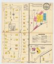
| Description: | Sanborn map of Sun Prairie, which includes an index and information about water facilities and the fire department. Includes a small inset map of the State... |

| Date: | 1889 |
|---|---|
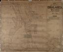
| Description: | This map lists township and section numbers outside municipality, housing additions and subdivisions and plat owners outside municipality, the Black River,... |

| Date: | 1795 |
|---|---|
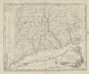
| Description: | Map of Connecticut showing counties, townships, cities, roads, islands, swamps, hills, mountains, lakes, rivers, reefs, and numerous other geographical and... |

| Date: | 1838 |
|---|---|
| Description: | Drawing of Shullsburg. There is a numbered key on the left that reads, at top: "Explanation. Nos. Denote present Site." Streets are named on the map and ma... |
If you didn't find the material you searched for, our Library Reference Staff can help.
Call our reference desk at 608-264-6535 or email us at: