 Filter: Categories of Wisconsin Historical Images
Filter: Subject of Maps
Filter: Subject of beavers
Filter: Categories of Wisconsin Historical Images
Filter: Subject of Maps
Filter: Subject of beavers
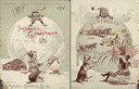
| Date: | 1894 |
|---|---|
| Description: | Front cover featuring a color illustration titled: "Young Canada, 'I wonder what they are doing on the other side,'" and "Merry Christmas." A young boy wea... |

| Date: | 1720 |
|---|---|
| Description: | One of Herman Moll's most famous maps, often referred to as The Beaver Map for its elaborate engraved inset depicting and describing beavers building a dam... |

| Date: | 1746 |
|---|---|
| Description: | Map of North America from the southern portion of James Bay to Florida. It shows the colonies, cities, Native American land, and topological and geographic... |

| Date: | 1780 |
|---|---|
| Description: | Map of North and South America, showing the boundaries of colonial territories, cities, settlements, rivers, lakes, and Native American land. Particular em... |

| Date: | 1636 |
|---|---|
| Description: | Map of North America, divided into regions, and showing some rivers, lakes, settlements, cities, mountains, and Native American land. Of the Great Lakes on... |

| Date: | 1755 |
|---|---|
| Description: | Large format map of America and Canada east of the Mississippi River. D'Anville marks the locations of rivers, lakes, settlements, cities, Native American ... |
If you didn't find the material you searched for, our Library Reference Staff can help.
Call our reference desk at 608-264-6535 or email us at: