 Filter: Categories of Wisconsin Historical Images
Filter: Subject of Lighthouses
Filter: Subject of human settlements
Filter: Categories of Wisconsin Historical Images
Filter: Subject of Lighthouses
Filter: Subject of human settlements

| Date: | 1941 |
|---|---|
| Description: | Elevated view of Sturgeon Bay in 1900. Sturgeon Bay Bridge spans the bay and several boats are on the water. A lighthouse sits on a small island in the bay... |

| Date: | 1966 |
|---|---|
| Description: | A colored map depiction of Door County, Wisconsin, with pictorial highlights, titled: "Door County — Wisconsin's Air Conditioned Peninsula Playground." |

| Date: | 01 06 1958 |
|---|---|
| Description: | View from jetty out towards Lake Michigan entrance to Ship Canal. A large tank, streetlamp and buildings are on the left. On the opposite jetty is a lighth... |

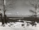
| Date: | 01 07 1958 |
|---|---|
| Description: | View from the Second Street bridge over the icy Ahnapee River towards Lake Michigan. A lighthouse is at the end of a jetty in the far background. Boats are... |

| Date: | |
|---|---|
| Description: | Aerial view of harbor. In the foreground is a lighthouse and breakwaters. Bridges cross the harbor, and there are factory and industrial buildings near the... |

| Date: | 07 19 1854 |
|---|---|
| Description: | This map shows the shore in 1844, 1850, and 1852, the length of and proposed additions to the pier. Relief is shown by hachures and depths are shown by sou... |

| Date: | 1848 |
|---|---|
| Description: | This map shows lighthouses on part of Lake Superior, Green Bay, Lake Michigan, Lake Huron, Lake St. Clair, Lake Erie, Lake Ontario, the St. Lawrence River,... |

| Date: | 1905 |
|---|---|
| Description: | This map shows railroads, towns, lights, lights to be established, fog signals, light-vessels, lighted buoys, light-house depots, and light-house reservati... |

| Date: | 1905 |
|---|---|
| Description: | This map shows railroads, towns, lights, lights to be established, fog signals, light-vessels, lighted buoys, light-house depots, and light-house reservati... |

| Date: | 1905 |
|---|---|
| Description: | This map shows railroads, towns, lights, lights to be established, fog signals, light-vessels, lighted buoys, light-house depots, and light-house reservati... |

| Date: | 1908 |
|---|---|
| Description: | This map shows railroads, towns, lights, lights to be established, fog signals, light-vessels, lighted buoys, light-house depots, and light-house reservati... |

| Date: | 1900 |
|---|---|
| Description: | This blue line print map shows land use, cables, U.S.L.S.S. walk and clearing, and front and rear range lights on the Porte des Morts Passage. Tree types a... |

| Date: | 1857 |
|---|---|
| Description: | This map shows lot and block numbers, streets, railroad depots, locks, bridges, dams, canals, U.S. light house, college grounds, a steam boat landing, and ... |

| Date: | 1970 |
|---|---|
| Description: | This map shows roads, parks, swimming beaches, golf courses, yacht harbors, light houses, airports, public hunting grounds, waysides, schools, and fishing ... |

| Date: | |
|---|---|
| Description: | View of the lake front at Lakeside Park, with a lighthouse and docked boats. Caption reads: "Light House and Harbor, Lakeside Park, Fond du Lac, Wis." |

| Date: | |
|---|---|
| Description: | View toward the two lighthouses on either side of Kenosha Harbor. The lighthouse on the right has an elevated walkway to the entrance. Caption reads: "Ligh... |

| Date: | |
|---|---|
| Description: | Illustration of a view across water towards a lighthouse and adjoining dwelling. Small boats are moored in the harbor. Caption reads: "The Old Government L... |

| Date: | |
|---|---|
| Description: | Illustration of view across water towards a lighthouse and surrounding buildings. Caption reads: "U.S. Light House, Kenosha, Wis." |

| Date: | 1911 |
|---|---|
| Description: | View of a Lake Michigan lighthouse, and a house with a man standing on the porch. Caption reads: "Light House, Manitowoc, Wis." |
| Date: | 1951 |
|---|---|
| Description: | The Manitowoc Breakwater Lighthouse entered service in 1918, was automated in 1971 and sold in 2009. The lighthouse is located on the end of a 400 foot bre... |
If you didn't find the material you searched for, our Library Reference Staff can help.
Call our reference desk at 608-264-6535 or email us at: