 Filter: Categories of Wisconsin Historical Images
Filter: Subject of Landforms
Filter: Subject of land
Filter: Subject of wisconsin state capitol
Filter: Categories of Wisconsin Historical Images
Filter: Subject of Landforms
Filter: Subject of land
Filter: Subject of wisconsin state capitol

| Date: | 1952 |
|---|---|
| Description: | Aerial view of a North Central Airlines DC-3 airplane flying over the Madison isthmus. Clearly visible are the Wisconsin State Capitol, the 1 West Wilson S... |

| Date: | 1908 |
|---|---|
| Description: | Colored map showing a panoramic view of Madison in great detail. The Wisconsin State Capitol is located at the center, with Lake Mendota in the background ... |

| Date: | 1908 |
|---|---|
| Description: | A panoramic aerial view of the Isthmus taken from a kite. Lake Mendota is to the right in the background with Picnic Point jutting into the lake. The photo... |

| Date: | 05 09 1908 |
|---|---|
| Description: | Kite aerial panoramic photograph of the central business district. In the distance is Lake Mendota. The fire damaged Wisconsin State Capitol is in the cent... |

| Date: | 1885 |
|---|---|
| Description: | Bird's-eye map of Madison, State Capital of Wisconsin, County Seat of Dane County, with inset of the Wisconsin State Capitol. |

| Date: | 1855 |
|---|---|
| Description: | Part of George Harrison's "Map of the City of Madison," showing the development of the isthmus and the small size of the second Capitol (54' x 104') in com... |

| Date: | 1896 |
|---|---|
| Description: | A portion of John B. Heim's map of the Water Works System of Madison showing the size of the third Wisconsin Capitol (228' x 226') in comparison with the C... |

| Date: | 1928 |
|---|---|
| Description: | Aerial view of Madison looking southeast over the isthmus, showing the Four Lakes Country. Visible at the bottom is the Lake Mendota shoreline. At center, ... |

| Date: | 1955 |
|---|---|
| Description: | An air view of Madison's downtown area with the Wisconsin State Capitol and new State Office Buildings. |

| Date: | 1950 |
|---|---|
| Description: | Aerial view of the Madison isthmus looking north. Caption reads: "Madison Wisconsin — Between Lake Mendota and Lake Monona". |

| Date: | 1919 |
|---|---|
| Description: | Aerial view with the Wisconsin State Capitol in the foreground, and the tip of Monona Bay and Lake Wingra to the left, with horizon stretching into the dis... |

| Date: | 1930 |
|---|---|
| Description: | Aerial view of isthmus looking east toward Lake Mendota and the Wisconsin State Capitol, with Lake Monona and the horizon in the background. |

| Date: | 1856 |
|---|---|
| Description: | Isthmus of Madison, including Lake Mendota, or Great Lake, and Lake Menona [sic]. |

| Date: | 02 09 1949 |
|---|---|
| Description: | Aerial view of Madison, looking east across the Isthmus including the Wisconsin State Capitol, Lake Mendota, and Lake Monona. |
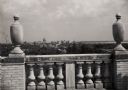
| Date: | 1931 |
|---|---|
| Description: | Tower view from the First Congregational Church of the University campus and University Avenue. Lake Mendota is in the background on the left. The Wisconsi... |
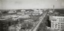
| Date: | 1945 |
|---|---|
| Description: | View of the Wisconsin State Capitol from balcony of Bascom Hall on the University of Wisconsin-Madison campus. Lake Monona is in the upper right background... |

| Date: | |
|---|---|
| Description: | Elevated panoramic view of the isthmus and the Wisconsin State Capitol building from the corner of Mifflin and State Streets. Lake Mendota and Lake Monona ... |

| Date: | 1900 |
|---|---|
| Description: | A Hydrographic map of Lake Mendota that shows the depths of the lake through contour lines and cross sections of the lake. Also shown in the map are the ad... |

| Date: | 1953 |
|---|---|
| Description: | A map of Lake Mendota that shows depths and the locations of various species of fish in lake. The maps also identifies a number of selected roads and stree... |

| Date: | 1900 |
|---|---|
| Description: | Elevated view of Madison through trees. Lake Mendota, buildings of the University of Wisconsin-Madison, including the Washburn Observatory are along the sh... |
If you didn't find the material you searched for, our Library Reference Staff can help.
Call our reference desk at 608-264-6535 or email us at: