 Filter: Categories of Wisconsin Historical Images
Filter: Subject of Land use, Rural
Filter: Year of 1900-1999
Filter: Type of Map or Atlas
Filter: Categories of Wisconsin Historical Images
Filter: Subject of Land use, Rural
Filter: Year of 1900-1999
Filter: Type of Map or Atlas
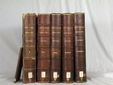
| Date: | 1908 |
|---|---|
| Description: | Five volumes of the Crown Collection of American Maps, plus an index, showing the spines of these books. |

| Date: | 1910 |
|---|---|
| Description: | Map of Dane County rural delivery in Madison and the town of Westport. |

| Date: | 1913 |
|---|---|
| Description: | Shows lands in green owned and for sale by Homeseekers Land Company, H.J. McKusick, Secretary. Map, part colored. No scale. Photographs on reverse of origi... |

| Date: | 1935 |
|---|---|
| Description: | This map shows in different colors virgin timberland, second growth timber, pasture belt, crop-pasture belt, intensive crop-pasture belt, intensive pasture... |

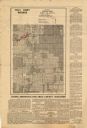
| Date: | 1938 |
|---|---|
| Description: | This map shows "regional designation problem areas" and "nature of problem or solution." The left margin has a key showing the problem areas. The right mar... |

| Date: | 1943 |
|---|---|
| Description: | A map that shows the lands for sale by the Tomahawk Land Company of Tomahawk, Wisconsin, in the counties of Langlade, Lincoln, Oneida, and Price. The map s... |

| Date: | 1952 |
|---|---|
| Description: | This map shows counties, towns, cities, and selected villages, as well as the Menominee Indian Reservation are identified on this U.S. Post Office. Circles... |
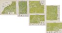
| Date: | 1975 |
|---|---|
| Description: | This series of six maps identifies land use in Taylor, Price, Rusk, Sawyer, Washburn, and Burnett counties based on data from 1966 through 1975. Each map i... |

| Date: | 1900 |
|---|---|
| Description: | This 1900 map of Walworth County, Wisconsin, shows the township and range grid, towns, sections, landownership and acreages, rural residences, cities and v... |

| Date: | 1943 |
|---|---|
| Description: | This 1943 map of Door County, Wisconsin, identifies the post offices and rural routes in the county. Highways and roads, cities and villages, and rural res... |
| Date: | 1935 |
|---|---|
| Description: | Map of a portion of Central Wisconsin with areas zoned for reforestation. The area is divided into two sites which are shaded in purple and red. |

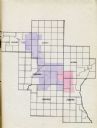
| Date: | 1935 |
|---|---|
| Description: | Map of Juneau County showing area zoned for reforestation shaded in red. |

| Date: | 1909 |
|---|---|
| Description: | This is one of a set of two topographical maps showing land use, roads, railroads, bridges, and buildings with ownership in parts of LaFayette, Greenfield,... |
| Date: | 1935 |
|---|---|
| Description: | This map shows land zoning. The top middle includes a key of land zones, forestry, recreation, and unrestricted. The map includes extensive text on zoning ... |

| Date: | 08 1960 |
|---|---|
| Description: | This map shows a detailed account of southwestern Wisconsin. Individual settlers, the type of trees that grow in given areas, the quality of the soil (labe... |
| Date: | 1900 |
|---|---|
| Description: | This map shows distances, land use, and landowners along the road from Racine to Janesville. The map is divided into several sheets with north typically or... |

| Date: | 1973 |
|---|---|
| Description: | This map shows the uses of land in St. Croix County. Uses are indicated by colored dots. Residential(Yellow), Commercial(Red), Industrial(Grey), Parks and ... |

| Date: | 1910 |
|---|---|
| Description: | This map of shows railway lines in red, with railroad land grant in Taylor, Price, and Ashland Counties shaded red, on top of the cities, counties, highway... |

| Date: | 1910 |
|---|---|
| Description: | This map shows the Soo Line railroad and Arpin Hardwood Lumber Company lands in red. The top margin of the map reads: "Wisconsin, the safest state in the U... |
If you didn't find the material you searched for, our Library Reference Staff can help.
Call our reference desk at 608-264-6535 or email us at:
