Filter: Categories of Wisconsin Historical Images
Filter: Subject of Indian reservations
Filter: Subject of land use
Filter: Categories of Wisconsin Historical Images
Filter: Subject of Indian reservations
Filter: Subject of land use
| Date: | |
|---|---|
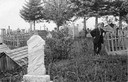
| Description: | Man posing by a gate in the Red Cliff Indian Reservation cemetery. |
| Date: | |
|---|---|
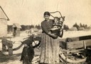
| Description: | A Chippewa (Ojibwa) mother with two children, one of whom is in a cradleboard, at the Lac du Flambeau reservation. This image is part of an exhibit about N... |
| Date: | |
|---|---|
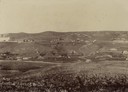
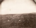
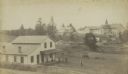
| Description: | Men walk on a hill at a Creek Nation Reservation, in Sapulpa, Indian Territory. |
| Date: | 1902 |
|---|---|
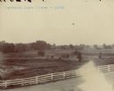
| Description: | Alfalfa fields, cultivated by Indians, at the Pyramid Lake Agency. |
| Date: | 1956 |
|---|---|
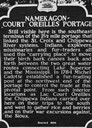
| Description: | Historical marker of the Namekagon Portage on the Lac Court Oreilles Native American Reservation. |

| Date: | |
|---|---|
| Description: | Lear Shewano sitting under very large trees on the Menominee Reservation. |
| Date: | 1929 |
|---|---|
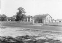
| Description: | The Government Indian School in Keshena. |
| Date: | 1929 |
|---|---|
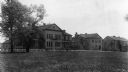
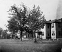
| Description: | The U.S. Department of the Interior, Keshena Indian School. |
| Date: | 1936 |
|---|---|
| Description: | St. Joseph's Indian School on the Keshena Menominee Reservation. |

| Date: | 1939 |
|---|---|
| Description: | A color, pictorial map. Scale: 10 miles to the inch. Shows state parks and forests, proposed state parkways, proposed state monuments and memorials, nation... |
| Date: | 1935 |
|---|---|
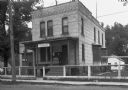
| Description: | U.S. Department of the Indian agency building on the Menominee Indian Reservation. |

| Date: | 1890 |
|---|---|
| Description: | Stereograph of Presbyterian Mission school. People gathered in front of building. Fence in foreground of photograph. |

| Date: | 1885 |
|---|---|
| Description: | Stereograph. Probably the Presbyterian Mission School grounds on the Chippewa Indian reservation. Two boys and a dog are standing in the foreground, with a... |
| Date: | 1890 |
|---|---|
| Description: | Farmer's house with rear of the government Contract School on the Menominee reservation in the distance. The Keshena Creek flows between the farmhouse and ... |

| Date: | 1952 |
|---|---|
| Description: | This map shows counties, towns, cities, and selected villages, as well as the Menominee Indian Reservation are identified on this U.S. Post Office. Circles... |

| Date: | 1872 |
|---|---|
| Description: | This map, which includes eastern Iowa, northern Illinois and a portion of Michigan's Upper peninsula, shows the township survey grid and identifies countie... |

| Date: | |
|---|---|
| Description: | A map that shows the Wisconsin Central Railway land grant lands for sale by the Soo Line, the Chicago, Milwaukee, and St. Paul Railway. Town sections, lak... |

| Date: | |
|---|---|
| Description: | Map of northern Iron County, Wisconsin, shows town sections and railroads in the towns of Saxon, Kimball, and Gurney. It also includes the area of the La P... |

| Date: | 1898 |
|---|---|
| Description: | This 1898 map of Sawyer County, Wisconsin, shows the township and range system, sections, roads, farm houses, camps, school houses, dams, bridges, Indian r... |
If you didn't find the material you searched for, our Library Reference Staff can help.
Call our reference desk at 608-264-6535 or email us at: