| Date: | 1867 |
|---|---|
| Description: | Bird's-eye map of Green Bay and Fort Howard, Brown Co., depicts street names and street layouts, houses, trees, and the East River. A reference key at the ... |

| Date: | 1870 |
|---|---|
| Description: | Bird's-eye view of Whitewater, with insets. |

| Date: | 1912 |
|---|---|
| Description: | A deer hunting party pose with carcasses and supplies by a train on the C. St. P. M. & O. railroad. |

| Date: | 1916 |
|---|---|
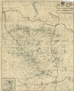
| Description: | This map shows the locations of hunting and fishing resorts in the northern Wisconsin counties of Forest, Iron, Oneida, and Vilas, and in Gogebic County in... |

| Date: | 1903 |
|---|---|
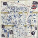
| Description: | A map of northern Wisconsin and Michigan showing the names and locations hunting and fishing resorts in the area, as well as location of Chicago and North ... |

| Date: | 1914 |
|---|---|
| Description: | Two maps of northern Wisconsin counties of Ashland, Barron, Bayfield, Chippewa, Douglas, Forest, Iron, Langlade, Lincoln, Oneida, Polk, Price, Sawyer, Tayl... |

| Date: | 1895 |
|---|---|
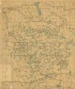
| Description: | This late 19th century map of northern Wisconsin and a portion of Michigan's Upper Peninsula shows the township and range grid, the (Lac du) Flambeau India... |

| Date: | 1976 |
|---|---|
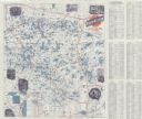
| Description: | Panel title. Shows railroads, roads, highways, boundaries, dams, public hunting and fishing grounds, cemeteries, forest ranger stations, plant life, and s... |

| Date: | 1908 |
|---|---|
| Description: | This map shows counties, roads, Lake Superior, Lake Michigan, and portions of surrounding states. Also included is a list of railroads showing miles and g... |

| Date: | 1910 |
|---|---|
| Description: | This map shows counties, roads, Lake Superior, Lake Michigan, and portions of surrounding states. Also included is a list of railroads showing miles and gr... |

| Date: | 1959 |
|---|---|
| Description: | This map shows public access sites, public beaches and parks, other public shorelines, boat liveries, public hunting and fishing grounds, railroads, roads,... |

| Date: | 1960 |
|---|---|
| Description: | This map shows improved town roads, federal highways, county highways, public boat access, public hunting areas, railroads, and lakes in the area around th... |

| Date: | 1952 |
|---|---|
| Description: | This map shows lakes, rivers, railroads, highways, roads, hunting grounds and trails around Flambeau Flowage and Boulder Junction in the north, to Brantwoo... |

| Date: | 1952 |
|---|---|
| Description: | This map shows hunting areas, lakes, rivers, railroads, highways, roads, and trails around Clam Lake, Glidden, and Flambeau Flowage in the north, to Hawkin... |

| Date: | 1921 |
|---|---|
| Description: | This map shows in red the NorthWestern Railway Line routes running from Chicago, Illinois to northern Wisconsin and Michigan. The map includes cities and t... |

| Date: | 1922 |
|---|---|
| Description: | This map shows in red the NorthWestern Railway Line routes running from Chicago, Illinois to northern Wisconsin. The map includes cities and towns, lakes, ... |
If you didn't find the material you searched for, our Library Reference Staff can help.
Call our reference desk at 608-264-6535 or email us at: