| Date: | 1898 |
|---|---|
| Description: | Bird's-eye map of Milwaukee with prominent streets and buildings identified. Taken from City Hall Tower. |

| Date: | 1869 |
|---|---|
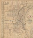
| Description: | This map was engraved from original drawings and surveys taken by Louis Lipman. Includes Milwaukee street directory on the left hand side. Bottom right cor... |

| Date: | 1891 |
|---|---|
| Description: | This maps has an index of depots, hotels, prominent institutions and buildings, churches, and places of amusement. The map was removed from an unidentified... |

| Date: | 1956 |
|---|---|
| Description: | Intended for tourists, this brochure features a map of Milwaukee's central business district as well as general information about parking, beaches and othe... |

| Date: | 1942 |
|---|---|
| Description: | This map shows the route of the Milwaukee Road, roads, foot trails, resorts, and ranger stations. The map includes text, illustrations, a railroad fare tab... |
If you didn't find the material you searched for, our Library Reference Staff can help.
Call our reference desk at 608-264-6535 or email us at: