
| Date: | 1823 |
|---|---|
| Description: | In 1823 U.S. Army major Stephen H. Long led an expedition of scientific, trade, and military investigation up the Mississippi River and the Red River of th... |
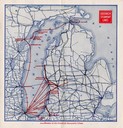
| Date: | 1930 |
|---|---|
| Description: | Page 8 of the 1930 schedule is a map of the routes of the Goodrich Steamship Lines in Lake Michigan and Lake Huron. |

| Date: | 1862 |
|---|---|
| Description: | Drawn the second year of the Civil War, this 1862 map of Milwaukee shows post offices, light houses, beacon lights, county buildings, elevator warehouses, ... |

| Date: | 1898 |
|---|---|
| Description: | Bird's-eye map, looking west from shoreline on Lake Michigan of Milwaukee to Golden Lake in Waukesha County, with Kenosha and Fox Point at bottom corners, ... |

| Date: | 1927 |
|---|---|
| Description: | Color map, hand-drawn with comic figures engaged in various activities throughout map. Bordered by the river on the left and Lake Michigan on the right, in... |

| Date: | 1879 |
|---|---|
| Description: | Bird's-eye map of Two Rivers. |

| Date: | 1632 |
|---|---|
| Description: | The Wisconsin portion of Champlain's 1632 map, augmented since the previous one, for navigation according to the true Meridien, by Sieur de Champlain. The ... |

| Date: | 1892 |
|---|---|
| Description: | Bird's-eye view of the Columbian Exposition pavilions from the vantage point of Lake Michigan. Included is an inset of the Union Passenger Station (now Uni... |

| Date: | 1844 |
|---|---|
| Description: | Map of Wisconsin including Lakes Michigan and Superior. Inset includes "N.W. Part of Wiskonsan." |

| Date: | 1670 |
|---|---|
| Description: | This map is in French and shows Lac Tracy ov Superieur (Lake Superior), Baye des Puans (Green Bay), and portions of Lac des Ilinois (Lake Michigan) and Lac... |

| Date: | 1776 |
|---|---|
| Description: | In French: "Partie Occidentale du Canada et septentrionale de la Louisiane avec une partie de la Pensilvanie." A map showing graticule and six European sca... |
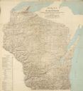
| Date: | 1910 |
|---|---|
| Description: | Wisconsin Geological and Natural History Survey, by Lawrence Martin reproduced from a model of the state prepared by W.O. Hotchkiss and F.T. Thwaites and m... |

| Date: | 1896 |
|---|---|
| Description: | Section 3 of 12, this bicycle road map features Wisconsin bicycle routes in the counties of Winnebago, Calumet, Manitowoc, Outagamie, Brown, Kewaunee, and ... |

| Date: | 1856 |
|---|---|
| Description: | A Wisconsin map showing the Wisconsin Superior and St. Croix Railroad. |
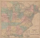
| Date: | 1860 |
|---|---|
| Description: | This colored map shows railroad lines east of the Mississippi as well as in the states bordering the Mississippi River. The Great Lakes and Gulf of Mexico ... |

| Date: | 1847 |
|---|---|
| Description: | In 1847, a year before Wisconsin entered statehood, most of the county shapes in southeastern and southern Wisconsin looked the same as they do today, wher... |

| Date: | 1855 |
|---|---|
| Description: | Drawn around 1855, this map shows the placement of railroad tracks in southern Wisconsin and northern Illinois connecting Milwaukee, Prairie du Chien, Gale... |
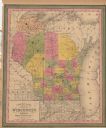
| Date: | 1852 |
|---|---|
| Description: | Map shows Wisconsin counties by color and includes rivers, lakes and some cities. This information is also given for eastern Minnesota and northern Illinoi... |
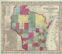
| Date: | 1856 |
|---|---|
| Description: | This map shows the entire state of Wisconsin with counties, cities and rivers. It includes an inset of the layout of the streets of Milwaukee and a chart w... |
If you didn't find the material you searched for, our Library Reference Staff can help.
Call our reference desk at 608-264-6535 or email us at: