Map or Atlas
Voyages Of Samuel de Champlain

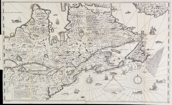
| The Wisconsin portion of Champlain's 1632 map, augmented since the previous one, for navigation according to the true Meridien, by Sieur de Champlain. The western portion of the map is based on verbal reports by Champlain's protege Etienn Brule, the only European thought to have visited the western Great lakes before Jean Nicolet in 1634. However Brule had died by 1632 and Champlain had never personally traveled to the far west, so the cartographer erroneously put Green Bay (the Bay of Puants) north of Sault Ste. Marie, rather than south of it. Ca. 1880 facsimile of the original 1632 map. |
| Image ID: | 27032 |
|---|---|
| Creation Date: | 1632 |
| Creator Name: | Champlain, Samuel de, 1567-1635 |
| City: | |
| County: | |
| State: | |
| Collection Name: | Map Collection |
| Genre: | Map or Atlas |
| Original Format Type: | prints, photomechanical |
| Original Format Number: | E186 P85 v. 11-13 |
| Original Dimensions: | 34 x 21 inches |
| Fields (Agriculture) |
| Fishes |
| Dwellings |
| Voyages and travels |
| Land |
| Landforms |
| Explorers |
| Great Lakes (North America) |
| Sailing ships |
| Lakes |
| Michigan, Lake |
| Rivers |
| This image is issued by the Wisconsin Historical Society. Use of the image requires written permission from the staff of the Collections Division. It may not be sold or redistributed, copied or distributed as a photograph, electronic file, or any other media. The image should not be significantly altered through conventional or electronic means. Images altered beyond standard cropping and resizing require further negotiation with a staff member. The user is responsible for all issues of copyright. Please Credit: Wisconsin Historical Society. |
| Location: | Wisconsin Historical Society Archives, 4th Floor, Madison, Wisconsin |
|---|
