
| Date: | 1942 |
|---|---|
| Description: | These three maps depict the locations of French missions and French forts in Wisconsin, as well as the French place names in the state. |

| Date: | 1941 |
|---|---|
| Description: | This pictorial map of Wisconsin with historical text highlights the history of the state and identifies places of interest, Indian villages, missions, trad... |

| Date: | 1911 |
|---|---|
| Description: | This hand-colored map is a 1911 copy of a map drawn by Gaspard-Joseph Chaussegros de Léry in 1730 showing the Fox River from its mouth at Green Bay to Lake... |
| Date: | 1972 |
|---|---|
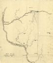
| Description: | Ink on tracing paper. This map shows rivers, Prairie du Chien, site of Fort Crawford, Excelsior, Fort Andrew, Boscobel, Blue River, Orion, Muscoda, Castle ... |

| Date: | 08 22 1943 |
|---|---|
| Description: | Corporal Eugene Cierzynski of Milwaukee, Wisconsin (left) instructs Corporal Edgar Hourscht of Trosky, Minnesota (right), on how to operate a D-8 Caterpill... |
| Date: | 08 31 1944 |
|---|---|
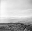
| Description: | Smoke rising from Cezembre Island, just north of Saint-Malo on the north coast of France. The island, which took a tremendous shelling, can barely be seen ... |
| Date: | 1918 |
|---|---|
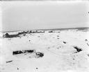
| Description: | Trenches constructed for American forces to defend against the Bolshevik "Red" forces. In the background are possibly barracks and other buildings for the ... |
| Date: | 10 29 1944 |
|---|---|
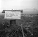
| Description: | A German warning sign nailed to a tree trunk. Just beyond the sign are dragon's teeth, concrete pyramids put in to stop tanks, on the Siegfried Line, a lin... |

| Date: | 1918 |
|---|---|
| Description: | Looking up at Blockhouse No. 4 while under construction. Trees around the constructions site are being used to provide camouflage. |

| Date: | 1918 |
|---|---|
| Description: | View looking up hill towards Blockhouse No. 1 that is constructed from timbers and earth. The fortification appears to be partially constructed into the to... |
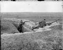
| Date: | 1918 |
|---|---|
| Description: | Two British soldiers posing in a trench. The soldier on the right is manning an air-cooled Vickers light machine gun, and the soldier on the left is holdin... |

| Date: | 1900 |
|---|---|
| Description: | This map of Green Bay shows plat of the town, lots by number, local streets, the military Fort Howard, part of Fox River and part of Navarino. The map feat... |

| Date: | 1930 |
|---|---|
| Description: | This map shows a plat of the town, local streets, railroads, creeks, part of Fox River, and part of the bay of Green Bay. The location of the original fort... |

| Date: | 1950 |
|---|---|
| Description: | Intended for tourists, this brochure features two maps with tourists sites along the Mississippi River. One map shows roads and populated places along the ... |

| Date: | 07 28 1934 |
|---|---|
| Description: | This map shows buildings and dimensions of Fort Crawford and hospital overlaid on a plat of existing lots, streets, and closed streets. |
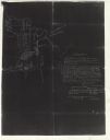
| Date: | 1900 |
|---|---|
| Description: | This photostat of a manuscript map originally drawn in 1829 shows landownership, buildings, including Fort Howard and U.S. sawmill, swamps, public barns an... |
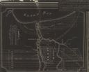
| Date: | 1900 |
|---|---|
| Description: | This photostat map shows private claim owners, natural meadows, roads, saw and grist mills, and Fort Howard. The upper right corner includes annotations an... |

| Date: | 1960 |
|---|---|
| Description: | This map is a facsimile of a 1829 map and shows private land claims, landowners within military reserve boundaries, sawmill, Fort Howard, public barns, bri... |
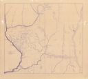
| Date: | 1900 |
|---|---|
| Description: | This map shows the boundary lines between ceded and unceded land in compliance with the Treaty of Prairie du Chen of 1829. It also shows roads, rivers, por... |
| Date: | 1900 |
|---|---|
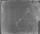
| Description: | This map shows portion of the military road from Fond du Lac to the Wisconsin River near Fort Winnebago, with mile markers and adjacent land use. A few pro... |
If you didn't find the material you searched for, our Library Reference Staff can help.
Call our reference desk at 608-264-6535 or email us at: