Filter: Categories of Wisconsin Historical Images
Filter: Subject of Formations (Geology)
Filter: Subject of coasts
Filter: Categories of Wisconsin Historical Images
Filter: Subject of Formations (Geology)
Filter: Subject of coasts
| Date: | |
|---|---|
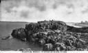
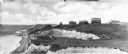
| Description: | Elevated view of Castle Rock, located on the coast, with numerous people looking out over the water. Caption reads: "Castle Rock, Marblehead, Mass." |
| Date: | |
|---|---|
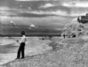
| Description: | View of men surf fishing along a rocky shoreline at Point State Park. |
| Date: | |
|---|---|
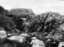
| Description: | View of the rocky coast of Maine as seen from a hillside. The rooftop of a dwelling is visible above a pine forest at right. |

| Date: | |
|---|---|
| Description: | View along shoreline toward a lighthouse and homes standing on Rocky Point. There are several boats anchored at the shore and in the water. |
| Date: | |
|---|---|
| Description: | Homes stand along the coast near cliffs on Block Island. |
| Date: | 1945 |
|---|---|
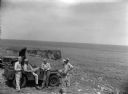
| Description: | Leota Kelly, directer of the Pacific Athletic Club, division of the Red Cross, and colleagues, at the site of the new Red Cross Club in Tinian near a cliff... |
| Date: | 1945 |
|---|---|
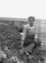
| Description: | Leota Kelly, director of the Red Cross's Pacific Athletic Club, posing for a picture by the shore in Tinian at the site of the new Red Cross Club. Kelly is... |

| Date: | 1911 |
|---|---|
| Description: | This 1911 map of the geology of northern Wisconsin between Superior and Hurley was published by the Wisconsin Geological and Natural History Survey in Fred... |
| Date: | 1990 |
|---|---|
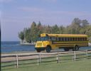
| Description: | Color photo of an International school bus driven along a coastal road. In the foreground is a split-rail fence and lawn. The photograph was probably taken... |

| Date: | 1847 |
|---|---|
| Description: | This map identifies surveyed areas of the Upper Peninsula and shows lakes, rivers, and islands in portions of Wisconsin, Minnesota, Michigan, and upper Can... |
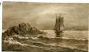
| Date: | |
|---|---|
| Description: | Watercolor painting of a sailing ship on a sea or ocean. A large rock formation is on the left. |

| Date: | |
|---|---|
| Description: | Color postcard across water towards a rock formation. Waves are breaking against the rocks below. In the upper-right corner of the postcard are cherries on... |
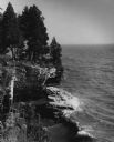
| Date: | 1962 |
|---|---|
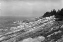
| Description: | Pine trees at the edge of the rocky shoreline in High Cliff Park on Lake Michigan. |
If you didn't find the material you searched for, our Library Reference Staff can help.
Call our reference desk at 608-264-6535 or email us at: