 Filter: Categories of Wisconsin Historical Images
Filter: Subject of Forests and forestry
Filter: Subject of water
Filter: Categories of Wisconsin Historical Images
Filter: Subject of Forests and forestry
Filter: Subject of water

| Date: | |
|---|---|
| Description: | Scenic view of the sun through clouds over a lake, identified as Lake Namakagon. In the foreground is a pine tree, and across the lake the opposite shoreli... |

| Date: | |
|---|---|
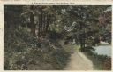
| Description: | View of a dirt road, cleared land, Jackson Lake and shoreline. Off to the far right is where the Nature Lovers Paradise resort cottages were located. A sig... |

| Date: | |
|---|---|
| Description: | View of the sun shining through clouds over a lake, identified as Lake Namakagon. In the foreground are some rocks on the shoreline, and more trees are vis... |

| Date: | |
|---|---|
| Description: | View of the sun shining through clouds over a lake, either Jackson Lake or Lake Namakagan. In the foreground are some trees, and more trees are visible on ... |

| Date: | 1911 |
|---|---|
| Description: | View down an unpaved road towards a four-story mill. Two boys pose on the side of the road. |

| Date: | 1935 |
|---|---|
| Description: | This three-part map from the U.S. Bureau of Public Roads identifies highways in Wisconsin that have been improved, indicating those which are federal highw... |

| Date: | 1936 |
|---|---|
| Description: | This 1936 Wisconsin Conservation Dept. map shows the locations of state forestry Civilian Conservation Corps (CCC) camps, closed state forestry CCC camps, ... |

| Date: | 05 01 1938 |
|---|---|
| Description: | This map shows the locations of Wisconsin Conservation Department forest protection districts and cooperative areas, state forests, national forests, India... |

| Date: | 1939 |
|---|---|
| Description: | This nine-part map from the U.S. Bureau of Public Roads identifies federal and state highways in Wisconsin by pavement type. County, forest, park, and publ... |

| Date: | 1944 |
|---|---|
| Description: | This nine-part map from the U.S. Bureau of Public Roads identifies federal and state highways in Wisconsin by pavement type. County, forest, park, and publ... |
| Date: | 08 1917 |
|---|---|
| Description: | Colorized postcard of a rural scene. A dirt path winds through the forest, and a pond or stream can be seen in the lower right corner. Text above reads: "A... |

| Date: | 1906 |
|---|---|
| Description: | A hand-colored commercial map of Wisconsin and portions of eastern Minnesota, Iowa, northern Illinois, and the Michigan’s Upper Peninsula. The map shows ra... |

| Date: | |
|---|---|
| Description: | Map of northern Iron County, Wisconsin, shows town sections and railroads in the towns of Saxon, Kimball, and Gurney. It also includes the area of the La P... |

| Date: | |
|---|---|
| Description: | Elevated view from hill towards five people standing on a hillside, facing the water. Text at right: "Wanderings Among the Wonders and Beauties of Wisconsi... |

| Date: | |
|---|---|
| Description: | Elevated view looking upriver towards two men sitting on rocks at Devils Elbow. Text at bottom reads: "In and About the Dells of The Wisconsin. Looking up ... |

| Date: | |
|---|---|
| Description: | A man and a boy sitting on a rock formation at Devil's Elbow. Text at right: "Wanderings Among the Wonders and Beauties of Wisconsin Scenery." |

| Date: | |
|---|---|
| Description: | Two men climbing Cleft Rock on East Bluff. Devil's Lake is in the background. Text at right: "Wanderings Among the Wonders and Beauties of Wisconsin Scener... |

| Date: | |
|---|---|
| Description: | Stereograph of a man sitting on a cliff. Text at right: "Wanderings Among the Wonders and Beauties of Wisconsin Scenery." |
| Date: | 1948 |
|---|---|
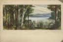
| Description: | Prior to the 1948 State Fair, artist Robert Hodgell traveled Wisconsin to study its many landscapes. He then produced a series of study sketches outlining ... |

| Date: | 1920 |
|---|---|
| Description: | This early 1920s map shows state-owned land in townships 38 and 39, range 7 east, the towns of Lake Tomahawk and Woodruff, in Oneida County, Wisconsin, tha... |
If you didn't find the material you searched for, our Library Reference Staff can help.
Call our reference desk at 608-264-6535 or email us at: