 Filter: Categories of Wisconsin Historical Images
Filter: Subject of Forests and forestry
Filter: Type of Map or Atlas
Filter: Subject of rivers
Filter: Categories of Wisconsin Historical Images
Filter: Subject of Forests and forestry
Filter: Type of Map or Atlas
Filter: Subject of rivers

| Date: | 1939 |
|---|---|
| Description: | A color, pictorial map. Scale: 10 miles to the inch. Shows state parks and forests, proposed state parkways, proposed state monuments and memorials, nation... |

| Date: | 1861 |
|---|---|
| Description: | Shows townships and sections, landowners, and woodlands. Includes inset maps of Monroe, Brodhead, Albany, Cadiz, Decatur, Dayton, Clarence, Springfield, Tw... |

| Date: | 1958 |
|---|---|
| Description: | Includes images of Flambeau River State Forest and a description of, canoeing and recreational activities in, and general park and forest information about... |

| Date: | 1935 |
|---|---|
| Description: | This map shows Wisconsin’s pinery region. Lake Superior, Lake Michigan, Lake Winnebago, Green Bay, the Wisconsin River, and the Mississippi River are label... |
| Date: | |
|---|---|
| Description: | This hand-colored map shows the Ranger District boundaryin blue, government lands in green, and "Opt. 9 Appr. Land" in yellow. |

| Date: | 1935 |
|---|---|
| Description: | This map shows in different colors virgin timberland, second growth timber, pasture belt, crop-pasture belt, intensive crop-pasture belt, intensive pasture... |

| Date: | 1935 |
|---|---|
| Description: | This three-part map from the U.S. Bureau of Public Roads identifies highways in Wisconsin that have been improved, indicating those which are federal highw... |

| Date: | 1936 |
|---|---|
| Description: | This 1936 Wisconsin Conservation Dept. map shows the locations of state forestry Civilian Conservation Corps (CCC) camps, closed state forestry CCC camps, ... |

| Date: | 05 01 1938 |
|---|---|
| Description: | This map shows the locations of Wisconsin Conservation Department forest protection districts and cooperative areas, state forests, national forests, India... |

| Date: | 1944 |
|---|---|
| Description: | This nine-part map from the U.S. Bureau of Public Roads identifies federal and state highways in Wisconsin by pavement type. County, forest, park, and publ... |

| Date: | 1906 |
|---|---|
| Description: | A hand-colored commercial map of Wisconsin and portions of eastern Minnesota, Iowa, northern Illinois, and the Michigan’s Upper Peninsula. The map shows ra... |

| Date: | |
|---|---|
| Description: | Map of northern Iron County, Wisconsin, shows town sections and railroads in the towns of Saxon, Kimball, and Gurney. It also includes the area of the La P... |

| Date: | 1967 |
|---|---|
| Description: | This tourist brochure for Bayfield County, Wisconsin, from 1967 includes a map of the county showing towns, cities and villages, highways and roads, railro... |

| Date: | 1937 |
|---|---|
| Description: | "Prepared ... March 1937." Includes location map. "State of Wisconsin, Conservation Department, Map Division"--upper left. From the E.P. Sherry papers rela... |

| Date: | 1935 |
|---|---|
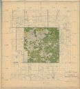
| Description: | Map of Juneau County showing area zoned for reforestation shaded in red. |

| Date: | 1970 |
|---|---|
| Description: | Color coded map. Legend in the top left hand corner reads: "EXISTING AIRPORT PAVEMENT" (purple), "FUTURE 5-YEAR DEVELOPMENT" (bright pink), "ULTIMATE AIRPO... |

| Date: | 1971 |
|---|---|
| Description: | A topgraphical map of Cable, Wisconsin showing railroads. |

| Date: | 1971 |
|---|---|
| Description: | A topographical map of Namekagon Lake and the surrounding area. |

| Date: | 1858 |
|---|---|
| Description: | This map shows city wards, streets, block and lot numbers, cemeteries, buildings, landownership, forests, railroads, a race course, quarries, and orchards.... |

| Date: | 1939 |
|---|---|
| Description: | This illustrated map shows counties, highways, rivers, roads, present and proposed state parks and forests, proposed state parkways, proposed state monumen... |
If you didn't find the material you searched for, our Library Reference Staff can help.
Call our reference desk at 608-264-6535 or email us at: