 Filter: Categories of Wisconsin Historical Images
Filter: Subject of Engraving
Filter: Subject of recreation
Filter: Subject of political science
Filter: Categories of Wisconsin Historical Images
Filter: Subject of Engraving
Filter: Subject of recreation
Filter: Subject of political science
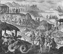
| Date: | 1655 |
|---|---|
| Description: | Scene from the Vespucci Expedition, 1499. |
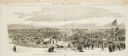
| Date: | 10 24 1863 |
|---|---|
| Description: | Panoramic wood-engraving of a cattle fair in New Haven, after a sketch by H.C. Curtis. Caption reads: "Cattle Show and Agricultural Faib [sic] at Ha... |

| Date: | 1870 |
|---|---|
| Description: | Magazine illustration of the home, titled: "Soldiers' National Asylum at Milwaukee, Wisconsin". The building is in the background, and in the foreground ar... |

| Date: | |
|---|---|
| Description: | Composite paste-up intended to represent "Old Abe," eagle mascot of the Eighth Wisconsin Regiment in the Civil War with his bearer. At the Northwest Sanita... |

| Date: | 12 1868 |
|---|---|
| Description: | Engraved view of four women racing on bicycles. Spectators in the background are behind a fence. |

| Date: | 1720 |
|---|---|
| Description: | One of Herman Moll's most famous maps, often referred to as The Beaver Map for its elaborate engraved inset depicting and describing beavers building a dam... |

| Date: | 1715 |
|---|---|
| Description: | One of Herman Moll's most famous maps, often referred to as The Codfish Map, it shows rivers and portages, cities, Indian villages, wind directions, routes... |

| Date: | 1890 |
|---|---|
| Description: | Advertisement for The Steam Yacht "Mendota." At the top is an engraving of the steam yacht under way loaded with passengers, and below is text. Some of the... |

| Date: | 1783 |
|---|---|
| Description: | Map of the newly formed United States showing borders, regions, Native American land, cities, mountains, lakes, and rivers. It includes a small inset map o... |

| Date: | 02 04 1783 |
|---|---|
| Description: | One of the first and few maps to attempt to map the new boundaries of the United States and British territories during the preliminary treaty at the end of... |
If you didn't find the material you searched for, our Library Reference Staff can help.
Call our reference desk at 608-264-6535 or email us at: