Filter: Categories of Wisconsin Historical Images
Filter: Subject of Engraving
Filter: Subject of battles
Filter: Subject of political science
Filter: Categories of Wisconsin Historical Images
Filter: Subject of Engraving
Filter: Subject of battles
Filter: Subject of political science
| Date: | 08 28 1833 |
|---|---|
| Description: | Indians fighting at Fort Mackenzie (Montana). |
| Date: | 1832 |
|---|---|
| Description: | Indians in combat at Fort McKenzie on August 28th, 1833. |
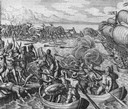
| Date: | 1655 |
|---|---|
| Description: | Battle during the Vespucci Expedition, 1499. |
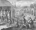
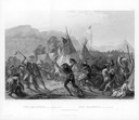
| Date: | 1655 |
|---|---|
| Description: | Scene from Vespucci Expedition, 1499. |

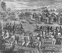
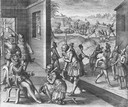
| Date: | 1655 |
|---|---|
| Description: | Girolamo Benzoni (1519-1570) was an Italian from Milan who spent the years 1541-1556 in the New World. His observations of Spanish imperialism were publish... |
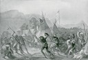
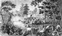
| Date: | 1655 |
|---|---|
| Description: | Scene from Laudonnière Expedition in Florida, ca. 1565. |

| Date: | |
|---|---|
| Description: | "Heroes of the Civil War". Engraving of eight Union leaders with decorative battlefield scenes. |
| Date: | |
|---|---|
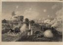
| Description: | Steel engraving of the first major battle of the Civil War, fought in Virginia, near the Manassas, Virginia, railway junction, after which the battle is ca... |
| Date: | 07 21 1861 |
|---|---|
| Description: | Depiction of the battlefield. Engraved by J.C. McRae and drawn by W. Momberger. |
| Date: | |
|---|---|
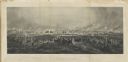
| Description: | Engraving excerpted from John S.C. Abbott's History of the Civil War in America. |
| Date: | |
|---|---|
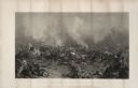
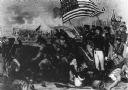
| Description: | An engraving after the painting by James Walker of the Battle of Gettysburg. |
| Date: | 1863 |
|---|---|
| Description: | An engraving of the Battle of Gettysburg, after the painting by P.F. Rothermel. |
| Date: | 03 15 1862 |
|---|---|
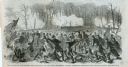
| Description: | Engraved Illustration for the story titled: "The Fight at Fort Donelson". The illustration shows the Second Iowa Volunteers regiment attacking Confederate ... |
| Date: | |
|---|---|
| Description: | Engraving of the Battle of New Orleans by Hall after W. Momberger. The Battle took place in January 1815 at the end of the War of 1812. American Forces wer... |

| Date: | 1740 |
|---|---|
| Description: | Engraved and hand-colored map of the Iberian peninsula as a theater of war during the War of the Spanish Succession (1701-1714). The map is dedicated to Ki... |

| Date: | 1733 |
|---|---|
| Description: | This map of North America shows settlements, rivers, lakes, Native American land, trade winds, and numerous topographical features such as forests and moun... |

| Date: | 1770 |
|---|---|
| Description: | Map of North America from the Great Lakes to the northern portion of South America. It shows cities, Native American land, mountains, swamps, lakes, rivers... |

| Date: | 1777 |
|---|---|
| Description: | Map of Colonial America east of Lake Michigan showing regions, cities, forts, Native American land, mountains, lakes, and rivers. Crossed swords and small ... |
If you didn't find the material you searched for, our Library Reference Staff can help.
Call our reference desk at 608-264-6535 or email us at: