Filter: Categories of Wisconsin Historical Images
Filter: Subject of Drawing
Filter: Subject of rivers
Filter: Categories of Wisconsin Historical Images
Filter: Subject of Drawing
Filter: Subject of rivers
| Date: | 1832 |
|---|---|
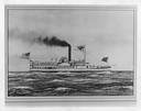
| Description: | An early type of sidewheel passenger and freight steamboat The Milwaukie, also known as The Milwaukee. It was used on Lake Erie and upper lak... |

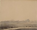
| Date: | 1955 |
|---|---|
| Description: | Artist's conception of ancient village of Aztalan, fortified with high walls surrounding it. |
| Date: | 07 03 1849 |
|---|---|
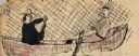
| Description: | Wilkins' wagons ferrying across the North Platte River in eastern Wyoming; sketched by Wilkins on his 151-day journey from Missouri to California on the Ov... |
| Date: | 07 07 1849 |
|---|---|
| Description: | The Buttes, Wyoming and Sweetwater River; sketched by Wilkins on his 151-day journey from Missouri to California on the Overland Trail (also known as the O... |
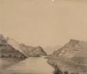
| Date: | 07 10 1849 |
|---|---|
| Description: | The clay hills that were formed by the Sweetwater River in Wyoming; sketched by Wilkins on his 151-day journey from Missouri to California on the Overland ... |
| Date: | 07 10 1849 |
|---|---|
| Description: | Devil's Gate in Wyoming; sketched by Wilkins on his 151-day journey from Missouri to California on the Overland Trail (also known as the Oregon Trail). |
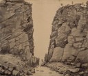
| Date: | 07 11 1849 |
|---|---|
| Description: | Sweetwater River in Wyoming; sketched by Wilkins on his 151-day journey from Missouri to California on the Overland Trail (also known as the Oregon Trail). |
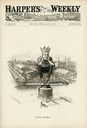
| Date: | 07 14 1894 |
|---|---|
| Description: | Cartoon depicting "King Debs" a man wearing a crown representing Debs American Railway Union, sitting atop the highway of trade. |
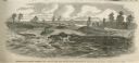
| Date: | 06 18 1864 |
|---|---|
| Description: | Engraved view of gunboats passing the dam in the Red River near Alexandria. |

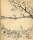
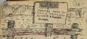
| Date: | 1833 |
|---|---|
| Description: | Drawing on a faint grid with Lake Michigan on the right, and the rivers on the left. Labeled is an Indian Village, J. Veiu, S. Juneau, and P. Juneau. Alo... |
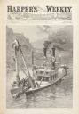
| Date: | 11 02 1889 |
|---|---|
| Description: | Engraved view of a government snagboat removing obstructions from the channel of a western river. |
| Date: | 1903 |
|---|---|
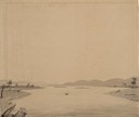
| Description: | Drawing of steamboat in the distance on a river (possibly the Wisconsin River). |
| Date: | 1903 |
|---|---|
| Description: | Lock and dam system on a canal along the Mississippi River. |
| Date: | 1903 |
|---|---|
| Description: | Sign posted on a fence announcing a lost camera near the town of Prairie du Sac and requesting its return to Herbert Fowler. |
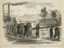
| Date: | 02 28 1863 |
|---|---|
| Description: | The First Regiment of the Louisiana Native Guards disembarking at Fort Macomb, Louisiana. The fort is adjacent to the Venetian Isles community, now legally... |

| Date: | |
|---|---|
| Description: | Christmas greeting card depicting the Benton-Franklin Inter-county bridge over the Columbia River connecting Kennewick and Pasco, Washington. A riverboat a... |

| Date: | |
|---|---|
| Description: | A copy of Robert Fulton's steamboat "Clermont" drawing. Illustration depicts a large steamboat on a river. Many people are on board. The boat features a sm... |

| Date: | |
|---|---|
| Description: | A hand-drawn map of the Guyandotte River. |

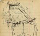
| Date: | 1851 |
|---|---|
| Description: | Map of a portion of Merton including the Bark River, a mill, Fort Hill, and Indian mounds. |
If you didn't find the material you searched for, our Library Reference Staff can help.
Call our reference desk at 608-264-6535 or email us at: