Filter: Categories of Wisconsin Historical Images
Filter: Subject of Cities and towns
Filter: Subject of farm buildings
Filter: Categories of Wisconsin Historical Images
Filter: Subject of Cities and towns
Filter: Subject of farm buildings

| Date: | 1873 |
|---|---|
| Description: | Main Street, with its dirt, ruts, cows (and presumably manure), but wide enough for easy hitching of wagons and teams. |
| Date: | |
|---|---|
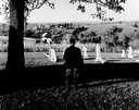
| Description: | Charles Green, the last survivor of the African American colony at Pleasant Ridge (near Lancaster, WI) looks out over the community graveyard. |
| Date: | 1900 |
|---|---|
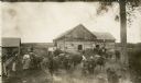
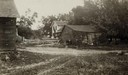
| Description: | Barnyard scene on the Rollo Shurfelt farm with people milking the cows. Several horses are in the yard as well. |
| Date: | 09 30 1933 |
|---|---|
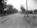
| Description: | A gas station in a Trachte building on the corner of Highway 51 (Monona Drive) and Highway 30 (Cottage Grove Road). "Johnson Gasoline," and "Defiance Spark... |
| Date: | 05 27 1961 |
|---|---|
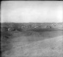
| Description: | A view overlooking the edge of the town, taken from an eastern slope, with a farm and cows in the foreground. |

| Date: | 1923 |
|---|---|
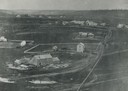
| Description: | Map of Oneida County-Rhinelander Airport which was laid out at the county fairgrounds. The map appears on the reverse side of a letter Roy Larson received ... |
| Date: | 06 30 1944 |
|---|---|
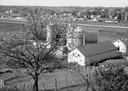
| Description: | Rennebohm Farm buildings, with house in foreground and barn and silos in background, located five miles from the Capitol, 3787 Highway 151 between Madison ... |

| Date: | 1910 |
|---|---|
| Description: | Elevated view of cattle yards near the railroad tracks. A farm and farm buildings can be seen in the background. |
| Date: | 1900 |
|---|---|
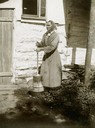
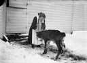
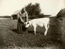
| Description: | Winter scene with Bertha Gesell feeding a calf from a pan. |
| Date: | 1905 |
|---|---|
| Description: | Woman feeding calf from a bucket. |
| Date: | 1873 |
|---|---|
| Description: | View across field towards the Amund Rustebakke farm. Twelve haystacks dominate the left and center of the image, and two people are standing on top of the ... |

| Date: | 1869 |
|---|---|
| Description: | People in carriage in front of picket fence, wagons and people behind; large frame house with parapet roof, Corinthian porch columns, brackets at roof; car... |
| Date: | 06 1925 |
|---|---|
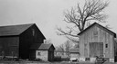
| Description: | View of three farm buildings - the one in the center is collapsing. |
| Date: | 1920 |
|---|---|
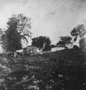
| Description: | View of a rocky pasture with some small, distant farm buildings, and a few farm animals grazing. |
| Date: | 1920 |
|---|---|
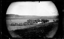
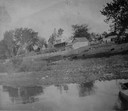
| Description: | View of farm buildings in the background on the top of a hill, with the shore of the lake in the foreground. |
| Date: | 02 21 1927 |
|---|---|
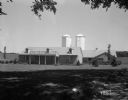
| Description: | Governor Taylor's farm with granary and barn. |

| Date: | 05 10 1928 |
|---|---|
| Description: | The Lutheran Church and buildings, seen from Lutheran Church Hill. |
| Date: | 1928 |
|---|---|
| Description: | View from hill of uptown Cross Plains with the Catholic Church (St. Francis Xavier) and farmhouses. |
If you didn't find the material you searched for, our Library Reference Staff can help.
Call our reference desk at 608-264-6535 or email us at: