| Date: | 1873 |
|---|---|
| Description: | Bird's-eye map of La Crosse from the Mississippi River. |

| Date: | |
|---|---|
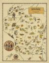
| Description: | Map reads: "Historic and Scenic Wisconsin — Land of Gathering Waters." In an inset there is a hand-painted depiction of the Wisconsin State Seal. For some ... |

| Date: | 1930 |
|---|---|
| Description: | Pictorial map of Glacier National Park, Montana and Waterton Lakes National Park, Alberta. Illustrated by Joe Scheurle, it depicts white people, American ... |

| Date: | 1924 |
|---|---|
| Description: | This pictorial map focuses on the Madison Isthmus, Lake Mendota, Lake Monona, Lake Wingra, and shows points of historical interest, buildings, parks, and I... |

| Date: | 1930 |
|---|---|
| Description: | Original map made with watercolor and inkwash. Includes a legend of buildings, roads, natural features and other details of the lodge. Inset at bottom has ... |

| Date: | 1975 |
|---|---|
| Description: | This map shows boundaries, roads, national forest land, bogs and wetlands, lakes, campgrounds, and boat landings. |

| Date: | 2000 |
|---|---|
| Description: | This map shows national parks, county and state forests, Indian reservations, municipal land, private land, docks, boat access, camping, and points of inte... |

| Date: | 1994 |
|---|---|
| Description: | This map shows historical sites, picnic grounds, public boat landings, canoe and motor boat trips, and resort locations. The left margin of the map include... |

| Date: | 1770 |
|---|---|
| Description: | Map of North America from the Great Lakes to the northern portion of South America. It shows cities, Native American land, mountains, swamps, lakes, rivers... |

| Date: | 1972 |
|---|---|
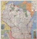
| Description: | This colored map displays Wisconsin and bordering areas of Iowa, Minnesota, and Michigan. There is color-coding on the map to indicate National Forests, an... |

| Date: | 1971 |
|---|---|
| Description: | This colored map displays Wisconsin and bordering areas of Iowa, Minnesota, and Michigan. There is color-coding on the map to indicate National Forests, an... |

| Date: | 1973 |
|---|---|
| Description: | This colored map displays Wisconsin and bordering areas of Iowa, Minnesota, and Michigan. There is color-coding on the map to indicate National Forests, a... |

| Date: | 1962 |
|---|---|
| Description: | This colored map represents "Tour #2" of a series of driving tours of the state published by the Sperry & Hutchinson Company, in order to "help you enjoy W... |

| Date: | 1962 |
|---|---|
| Description: | This colored map represents "Tour #1" of a series of driving tours of the state published by the Sperry & Hutchinson Company, in order to "help you enjoy W... |
If you didn't find the material you searched for, our Library Reference Staff can help.
Call our reference desk at 608-264-6535 or email us at: