| Date: | 1972 |
|---|---|
| Description: | Imaginative pen-and-ink drawing of a view from across a stream towards a cigar-smoking fisherman (probably Sid Boyum) on the opposite side of the bank. He ... |

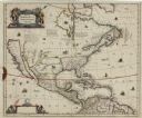
| Date: | 1636 |
|---|---|
| Description: | Map of North America, divided into regions, and showing some rivers, lakes, settlements, cities, mountains, and Native American land. Of the Great Lakes on... |

| Date: | 1740 |
|---|---|
| Description: | Map including the regions and cities of the northern half of North America. Native American land, rivers, lakes, mountains are labeled. Mountains, marshes,... |
If you didn't find the material you searched for, our Library Reference Staff can help.
Call our reference desk at 608-264-6535 or email us at: