 Filter: Categories of Wisconsin Historical Images
Filter: Subject of Animals
Filter: Type of Map or Atlas
Filter: Subject of land
Filter: Categories of Wisconsin Historical Images
Filter: Subject of Animals
Filter: Type of Map or Atlas
Filter: Subject of land

| Date: | 1867 |
|---|---|
| Description: | Bird's-eye map of Green Bay and Fort Howard, Brown Co., depicts street names and street layouts, houses, trees, and the East River. A reference key at the ... |

| Date: | 1882 |
|---|---|
| Description: | Bird's-eye views of various sections of Milwaukee. |

| Date: | 1878 |
|---|---|
| Description: | Bird's-eye map of Chilton with insets of points of interest, including P.H. Becker's Brewery, Chilton House, and Gutheil's Block. |

| Date: | 1880 |
|---|---|
| Description: | Bird's-eye map over the Mississippi River of Fountain City. Paddle steamers and steamboats are on the river, and bluffs are in the background. |

| Date: | 1883 |
|---|---|
| Description: | Bird's-eye map of Prairie du Sac, Wisconsin with an inset of Clifton. |

| Date: | 1879 |
|---|---|
| Description: | Bird's-eye view of Viroqua, county seat of Vernon County. |

| Date: | 1632 |
|---|---|
| Description: | The Wisconsin portion of Champlain's 1632 map, augmented since the previous one, for navigation according to the true Meridien, by Sieur de Champlain. The ... |

| Date: | 1930 |
|---|---|
| Description: | Pictorial map of Glacier National Park, Montana and Waterton Lakes National Park, Alberta. Illustrated by Joe Scheurle, it depicts white people, American ... |

| Date: | 1930 |
|---|---|
| Description: | The back of the pictorial map titled Recreational Map of Glacier National Park, Montana: Waterton Lakes National Park, Alberta. 14 panels of text and photo... |

| Date: | 1941 |
|---|---|
| Description: | This pictorial map of Wisconsin with historical text highlights the history of the state and identifies places of interest, Indian villages, missions, trad... |

| Date: | 1844 |
|---|---|
| Description: | Part of a series of local maps, showing a number of burial mounds in the shape of animals near Madison, Wisconsin along military road. The maps also show d... |

| Date: | 1936 |
|---|---|
| Description: | This pictorial tourist map from the Wisconsin Conservation Commission depicts vacation activities and identifies tourist destinations throughout the state.... |

| Date: | 1947 |
|---|---|
| Description: | A map of Manitowoc County that shows the location and dates of seven pig fairs in the county; it also lists monthly pig and cattle sales in the surrounding... |

| Date: | 1953 |
|---|---|
| Description: | A map of Lake Mendota that shows depths and the locations of various species of fish in lake. The maps also identifies a number of selected roads and stree... |

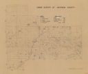
| Date: | 1948 |
|---|---|
| Description: | This outline map of Sauk County, Wisconsin, shows the towns, cities and villages, railroads, and streams in the county. |
| Date: | 1991 |
|---|---|
| Description: | A map of Shawano Lake. Lake depths are shown by isolines. "Not intended for navigation." It includes a location map and a list of fish. |

| Date: | 1949 |
|---|---|
| Description: | This 1949 map shows the topography and significant landmarks in Copper Falls State Park, Ashland County, Wisconsin. On the verso is a black-and-white image... |

| Date: | 1990 |
|---|---|
| Description: | This tourism brochure of Ashland County, Wisconsin, from the Ashland Area Chamber of Commerce includes a map of the county showing tourist destinations and... |

| Date: | 1625 |
|---|---|
| Description: | An illustrated map of the world with captions in Latin. Illustrations include depictions of the seasons and the elements. |
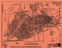
| Date: | 1939 |
|---|---|
| Description: | Shows location of deer, partridge, quail, prairie chicken, and pheasants. Includes game count table and significant manuscript annotations. Dated "3-25-39.... |
If you didn't find the material you searched for, our Library Reference Staff can help.
Call our reference desk at 608-264-6535 or email us at: