| Date: | 1908 |
|---|---|
| Description: | This map shows counties, roads, Lake Superior, Lake Michigan, and portions of surrounding states. Also included is a list of railroads showing miles and g... |

| Date: | 1908 |
|---|---|
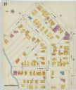
| Description: | Sanborn map of Madison, including West Gilman and Langdon Streets. |

| Date: | 1908 |
|---|---|
| Description: | This map shows railroads, towns, lights, lights to be established, fog signals, light-vessels, lighted buoys, light-house depots, and light-house reservati... |

| Date: | 1908 |
|---|---|
| Description: | This blueprint map is showing subdivisions and additions. Streets, rivers, and land plots are labeled. |

| Date: | 1908 |
|---|---|
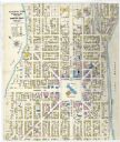
| Description: | A Sanborn map featuring the Capitol Square and surrounding business district. |

| Date: | 1908 |
|---|---|
| Description: | A Sanborn fire map of Brodhead. Includes an inset at top right showing distances from P.O. |

| Date: | 1908 |
|---|---|
| Description: | A Sanborn map of the isthmus, which includes the map key. |

| Date: | 1908 |
|---|---|
| Description: | A Sanborn map including a portion of the East Johnson Street and East Gorham Street neighborhood. |
If you didn't find the material you searched for, our Library Reference Staff can help.
Call our reference desk at 608-264-6535 or email us at: