 Filter: Categories of Wisconsin Historical Images
Filter: FULL_DATE of 1905
Filter: Type of Map or Atlas
Filter: Subject of rivers
Filter: Subject of land
Filter: Categories of Wisconsin Historical Images
Filter: FULL_DATE of 1905
Filter: Type of Map or Atlas
Filter: Subject of rivers
Filter: Subject of land

| Date: | 1905 |
|---|---|
| Description: | A reproduction of the Wisconsin portion of Louis Hennepin's 1698 map showing the location of the Ho-Chunk Tribe, the Hurons, the Illinois as well as other ... |
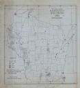
| Date: | 1905 |
|---|---|
| Description: | A map of showing the population density of foreign-born Scandinavians in Wisconsin based information from the 1905 census. The map also shows the county bo... |

| Date: | 1905 |
|---|---|
| Description: | This early 20th century map identifies the locations of the Divide Resort and Spider Lake Resort in Vilas County, Wisconsin. Also shown are trails, stage l... |

| Date: | 1905 |
|---|---|
| Description: | This pictorial representation of part of Lake Winnebago and the Fox River in 1703, showing interactions between white beaver hunters and the Iroquois is ta... |

| Date: | 1905 |
|---|---|
| Description: | This map shows roads, railroads, and location of Keyes Springs, now part of Monona. The map reads: "L.S. Smith, c.e., del. May, 1905" and "For further info... |

| Date: | 1905 |
|---|---|
| Description: | This blueprint map shows rivers, land parcels, and streets. It also highlights selected public and industrial buildings. |
If you didn't find the material you searched for, our Library Reference Staff can help.
Call our reference desk at 608-264-6535 or email us at:
