 Filter: Categories of Wisconsin Historical Images
Filter: FULL_DATE of 1880
Filter: Subject of human settlements
Filter: Type of Map or Atlas
Filter: Categories of Wisconsin Historical Images
Filter: FULL_DATE of 1880
Filter: Subject of human settlements
Filter: Type of Map or Atlas

| Date: | 1880 |
|---|---|
| Description: | Bird's-eye view of Jefferson on the Rock River. |

| Date: | 1880 |
|---|---|
| Description: | Alma was platted and settled in 1855, on a narrow strip of land between high bluffs and the Mississippi River. Its location made it a popular shipping cent... |

| Date: | 1880 |
|---|---|
| Description: | Bird's-eye map of Waukesha, county seat of Waukesha County. |

| Date: | 1880 |
|---|---|
| Description: | Bird's-eye map over the Mississippi River of Fountain City. Paddle steamers and steamboats are on the river, and bluffs are in the background. |

| Date: | 1880 |
|---|---|
| Description: | Bird's-eye map of Neillsville, with inset. |

| Date: | 1880 |
|---|---|
| Description: | Bird's-eye map of Sturgeon Bay. County Seat of Door County. |

| Date: | 1880 |
|---|---|
| Description: | This map shows railroads by operator and projected railroads. Portions of Lake Michigan, Lake Superior, Illinois, Iowa, Michigan and Minnesota are labeled. |

| Date: | 1880 |
|---|---|
| Description: | A hand-colored map of the Chippewa, Price, Taylor and the northern part of Clark counties, which shows the locations of farmhouses, schoolhouses, churches,... |

| Date: | 1880 |
|---|---|
| Description: | Map of Wisconsin including the eastern portions on Minnesota, Iowa, northern Illinois, and the western most portion of Michigan’s Upper Peninsula, showing ... |

| Date: | 1880 |
|---|---|
| Description: | A hand-colored, sectional map of Wisconsin showing the township grid, railroads, counties, towns, cities, villages, and the Menomonee, Oneida, Flambeau, an... |

| Date: | 1880 |
|---|---|
| Description: | This copy of an 1834 map in the American Fur Company's papers held by the New-York Historical Society shows an outline of Chequamegon Bay and Madeline Isla... |

| Date: | 1880 |
|---|---|
| Description: | This 1880 map of Clark County, Wisconsin, shows the township and range grid, towns, sections, cities and villages, railroads, roads, rivers and lakes, dams... |
| Date: | 1880 |
|---|---|
| Description: | This plat of Vanceburg Cemetery, Town of Sheridan, Dunn County, Wisconsin, likely dates from the 1880s and "is intended for the correction of names of peop... |

| Date: | 1880 |
|---|---|
| Description: | Map created from original drawing and surveys taken by Silas Chapman. Bottom right corner features a reference key. There is a street guide on the left sid... |

| Date: | 1880 |
|---|---|
| Description: | This map of La Crosse shows the Chicago, Milwaukee and St. Paul Railroad, the Southern Minnesota Railroad and the Chicago, Dubuque and Minnesota Railroad, ... |

| Date: | 1880 |
|---|---|
| Description: | This map of the southern part of La Crosse is pen on cloth and shows proposed streets crossing the lands of Jane Usher and the Green Bay, Winona and St. Pa... |

| Date: | 1880 |
|---|---|
| Description: | This map covers parts of Minnesota, Iowa, and South Dakota and advertised 1,000,000 acres of land available. Communities, roads, and railroad lines are lab... |

| Date: | 1880 |
|---|---|
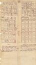
| Description: | This map shows wards, roads, railroads, lot and block numbers, subdivisions, parks, and some landownership. A handwritten annotation in red reads: "Note: S... |
If you didn't find the material you searched for, our Library Reference Staff can help.
Call our reference desk at 608-264-6535 or email us at:

