 Filter: Categories of Wisconsin Historical Images
Filter: FULL_DATE of 1864
Filter: Type of Map or Atlas
Filter: Subject of transportation
Filter: Categories of Wisconsin Historical Images
Filter: FULL_DATE of 1864
Filter: Type of Map or Atlas
Filter: Subject of transportation

| Date: | 1864 |
|---|---|
| Description: | Map reads: "Johnson's Wisconsin and Michigan". There is a decorative border, a scale of which ten miles is approximately one inch and individual counties d... |
| Date: | 1864 |
|---|---|
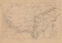
| Description: | This map shows the routes of the cavalry and of the 14th, 15th, 17th, and 20th Army Corps Atlanta, Ga., to Goldsboro, N.C., during February and March, 1865... |

| Date: | 1864 |
|---|---|
| Description: | This map of the Atlanta area shows entrenchments, relief by hachures, vegetation, drainage, roads, railroads, towns, and the names of a few residents in th... |

| Date: | 1864 |
|---|---|
| Description: | This colored map shows cities, rail lines, and geographic features in eastern Virginia. Circles around Richmond at 10 mile intervals indicate distances fro... |

| Date: | 1864 |
|---|---|
| Description: | This map of the battlefield at Wilderness, Virginia, illustrates the Union positions in blue and Confederate positions in red. Roads, railroads, vegetation... |

| Date: | 1864 |
|---|---|
| Description: | This battlefield map of the Battle of Totopotomoy Creek, also known as the Battle of Bethesda Church, shows the railroads, roads, vegetation and topography... |

| Date: | 1864 |
|---|---|
| Description: | This battlefield map of the Battle of Totopotomoy Creek, also known as the Battle of Bethesda Church, shows the railroads, roads, vegetation and topography... |

| Date: | 1864 |
|---|---|
| Description: | This map depicts the positions of Union forces, in blue, and Confederate forces, in red, at the end of 1863 after the cessation of the Knoxville Campaign. ... |

| Date: | 1864 |
|---|---|
| Description: | This map of the area of the First Battle of Bull Run shows military positions and troop movements as well as the names of landowners, vegetation and land u... |

| Date: | 1864 |
|---|---|
| Description: | This map created during the Civil War indicates Confederate fortifications, houses, names of residents, towns, roads, railroads, relief by hachures, draina... |

| Date: | 1864 |
|---|---|
| Description: | Map of eastern Virginia and part of Maryland, showing engagements by crossed swords, fortifications surrounding Richmond, routes of the opposing armies fro... |
| Date: | 1864 |
|---|---|
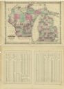
| Description: | A map of Wisconsin and Michigan showing the counties, named towns, cities and villages, and railroads. The opposite side includes a lists counties with pop... |

| Date: | 1864 |
|---|---|
| Description: | A hand-colored survey map of southeastern Minnesota and Wisconsin, showing the locations of railroads, land grant railroads, land offices, and the 6 and 15... |

| Date: | 1864 |
|---|---|
| Description: | This map of the entire state of Wisconsin depicts the township survey grid and identifies counties, named towns, cities and villages, rivers, lakes, railro... |

| Date: | 1864 |
|---|---|
| Description: | This map is ink, pencil, and color on paper and shows numbered lots and labeled streets. The bottom margin of the map reads: "Recorded in the Registry of d... |

| Date: | 1864 |
|---|---|
| Description: | This map shows locations of quarries, sink holes, creeks, springs, rivers, houses, forts, and roads. Annotations in pencil read: "Is the top of the mound l... |

| Date: | 1864 |
|---|---|
| Description: | This map shows locations of quarries, sink holes, creeks, springs, rivers, houses, forts, and roads. The upper right corner and right margin includes anno... |

| Date: | 1864 |
|---|---|
| Description: | Map showing locations of quarries, sink holes, creeks, springs, rivers, houses, forts, and roads. The map appears to have been drawn on to of a plat map of... |

| Date: | 1864 |
|---|---|
| Description: | This map shows locations of quarries, sink holes, creeks, springs, rivers, houses, forts, and roads. |

| Date: | 1864 |
|---|---|
| Description: | This map shows land owners, buildings, cities and villages, lakes, rivers, and roads. The margins include inset maps: Berlin; Mill Point; Holland; Ferrisvi... |
If you didn't find the material you searched for, our Library Reference Staff can help.
Call our reference desk at 608-264-6535 or email us at: