 Filter: Categories of Wisconsin Historical Images
Filter: FULL_DATE of 1864
Filter: Type of Map or Atlas
Filter: Subject of cities and towns
Filter: Categories of Wisconsin Historical Images
Filter: FULL_DATE of 1864
Filter: Type of Map or Atlas
Filter: Subject of cities and towns

| Date: | 1864 |
|---|---|
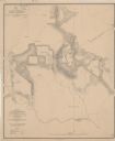
| Description: | Map reads: "Johnson's Wisconsin and Michigan". There is a decorative border, a scale of which ten miles is approximately one inch and individual counties d... |

| Date: | 1864 |
|---|---|
| Description: | (U.S. 39th Cong. 1stt Sess. Report of Chief engineer) The legend in the upper left corner contains a brief resume of each day's action while the map sho... |
| Date: | 1864 |
|---|---|
| Description: | This map depicts the battlefield at Todd's Tavern, Va., the site of a battle on May 7-8, 1864. Depicted are roads, houses, drainage, vegetation and troop p... |

| Date: | 1864 |
|---|---|
| Description: | This map of the Battle of Gettysburg indicates Union positions in red and Confederate positions in blue. Also shown are artillery positions, roads, railroa... |

| Date: | 1864 |
|---|---|
| Description: | This map of the Atlanta area shows entrenchments, relief by hachures, vegetation, drainage, roads, railroads, towns, and the names of a few residents in th... |
| Date: | 1864 |
|---|---|
| Description: | This map of northwestern Georgia shows dates and troop positions between Chattanooga, Tennessee, and Jonesboro, Georgia, May-September, 1864. Wisconsin uni... |

| Date: | 1864 |
|---|---|
| Description: | This map of the battlefield on the North Anna River at Hanover Junction illustrates the Union positions in blue and Confederate positions in red. Roads, ra... |

| Date: | 1864 |
|---|---|
| Description: | This colored map shows cities, rail lines, and geographic features in eastern Virginia. Circles around Richmond at 10 mile intervals indicate distances fro... |

| Date: | 1864 |
|---|---|
| Description: | This colored map of the southern and eastern states shows locations of battles and skirmishes from 1861 through May 1864 with red dots or red underlining o... |

| Date: | 1864 |
|---|---|
| Description: | This battlefield map of the Battle of Totopotomoy Creek, also known as the Battle of Bethesda Church, shows the railroads, roads, vegetation and topography... |

| Date: | 1864 |
|---|---|
| Description: | This battlefield map of the Battle of Totopotomoy Creek, also known as the Battle of Bethesda Church, shows the railroads, roads, vegetation and topography... |

| Date: | 1864 |
|---|---|
| Description: | This map created during the Civil War indicates Confederate fortifications, houses, names of residents, towns, roads, railroads, relief by hachures, draina... |

| Date: | 1864 |
|---|---|
| Description: | Map of eastern Virginia and part of Maryland, showing engagements by crossed swords, fortifications surrounding Richmond, routes of the opposing armies fro... |
| Date: | 1864 |
|---|---|
| Description: | This map illustrates the route taken by the 3rd Division, 20th Corps, Army of the Cumberland under the command of Daniel Butterfield from the Snake Creek G... |
| Date: | 1864 |
|---|---|
| Description: | Map of northwestern Georgia shows Union and Confederate troop positions between Chattanooga, Tenn., and Jonesboro, Ga., May-Sept., 1864. Wisconsin units in... |
| Date: | 1864 |
|---|---|
| Description: | This pen and ink tracing illustrates the route traveled by Sherman's troops through Georgia, South Carolina, and North Carolina in the winter and spring of... |
| Date: | 1864 |
|---|---|
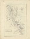
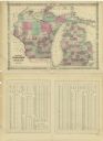
| Description: | A map of Wisconsin and Michigan showing the counties, named towns, cities and villages, and railroads. The opposite side includes a lists counties with pop... |

| Date: | 1864 |
|---|---|
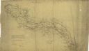
| Description: | A hand-colored survey map of southeastern Minnesota and Wisconsin, showing the locations of railroads, land grant railroads, land offices, and the 6 and 15... |

| Date: | 1864 |
|---|---|
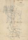
| Description: | This map of the entire state of Wisconsin depicts the township survey grid and identifies counties, named towns, cities and villages, rivers, lakes, railro... |

| Date: | 1864 |
|---|---|
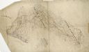
| Description: | This map is pen and watercolor on paper and shows profile and geological formation of Blue Mound and location of Arnold’s Hotel and Brigham Lead Mines. |
If you didn't find the material you searched for, our Library Reference Staff can help.
Call our reference desk at 608-264-6535 or email us at: