| Date: | 1861 |
|---|---|
| Description: | Bird's-eye map of Fond du Lac, "drawn after nature," with a parade of soldiers marching down the street. |

| Date: | 1861 |
|---|---|
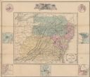
| Description: | A general map of Pennsylvania, Virginia, New Jersey and Delaware. Insets include maps of New Orleans, Baltimore, St. Louis, Charleston, Savannah, Washingto... |

| Date: | 1861 |
|---|---|
| Description: | This map was reproduced photographically and issued in Augusta, Ga., in the early days of the Civil War. It includes panels showing Virginia, Maryland, the... |

| Date: | 1861 |
|---|---|
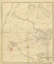
| Description: | This map shows Manassas during the First Battle of Bull Run, in which the 2nd Wisconsin Infantry fought, and the Leesburg area, the site of the Battle of B... |
If you didn't find the material you searched for, our Library Reference Staff can help.
Call our reference desk at 608-264-6535 or email us at: