| Date: | 1840 |
|---|---|
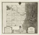
| Description: | This map is pencil on paper and shows rivers, granite locations, and selected landmarks. Relief is shown by hachures. |

| Date: | 1890 |
|---|---|
| Description: | This blue line print map created sometime between 1886 and 1916 covers parts of northern Taylor County and eastern Sawyer and Rusk counties Each of the tow... |

| Date: | 1903 |
|---|---|
| Description: | This blue line print shows quartzite areas, mines, railroads, and roads. The map covers townships 11-13 north, ranges 4-8 east, in parts of Sauk and Columb... |

| Date: | 1904 |
|---|---|
| Description: | This blue line print map includes 4 cross sections with relief shown by contours and spot heights. The topography was taken from the United States Geologic... |

| Date: | 1910 |
|---|---|
| Description: | This map shows the Soo Line railroad and Arpin Hardwood Lumber Company lands in red. The top margin of the map reads: "Wisconsin, the safest state in the U... |

| Date: | 1940 |
|---|---|
| Description: | This blue line print map traced from aerial survey mosaic shows reservation boundary, roads, trails, and railroads. Color manuscript annotations show triba... |

| Date: | 1925 |
|---|---|
| Description: | This map shows trails, mounds, villages, corn fields, and contemporary civil townships; some villages and features include both Indian and English place na... |

| Date: | 1939 |
|---|---|
| Description: | This map originally dated March 18, 1920 and revised for this edition. The map shows the original meander line of 'Shebowegan Lake' established by 1850 sur... |

| Date: | 1935 |
|---|---|
| Description: | This map is presented by Conoco, and shows the major roads, cities, lakes, and rivers, as well as some of the neighboring states. It includes an index, sca... |

| Date: | 1935 |
|---|---|
| Description: | This blue lined map shows the major roads and cities of Wisconsin. The map includes an index, hotel and cafe advertisements, as well as advertisements for ... |

| Date: | 1935 |
|---|---|
| Description: | This blue lined map ("compliments of Black Eagle Oil Company") shows the major roads and cities of Wisconsin. The map includes an index, hotel and cafe adv... |

| Date: | 1930 |
|---|---|
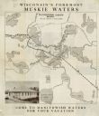
| Description: | This map shows roads and lakes and includes an inset illustration of Manitowish Waters Fish Hatchery. The back of the map includes a resorts directory, tex... |

| Date: | 1975 |
|---|---|
| Description: | This map shows nature trails, public attractions, public hunting and fishing grounds, dams, waysides, lakes, highways, and roads. The upper right corner in... |

| Date: | 1983 |
|---|---|
| Description: | This map covers Vilas county as well as parts of Iron, Oneida, and Forest counties. Club trails are shown in dotted red lines and state trails are shown in... |

| Date: | 1994 |
|---|---|
| Description: | This map shows historical sites, picnic grounds, public boat landings, canoe and motor boat trips, and resort locations. The left margin of the map include... |

| Date: | 1934 |
|---|---|
| Description: | This map shows the area as it appeared in 1848 and includes buildings, land use, and roads with distances to nearby locations. The upper right corner reads... |

| Date: | 1929 |
|---|---|
| Description: | This map with north oriented to the upper left shows military forts, Indian villages, settler's houses with surnames, trading houses, lodges and encampment... |

| Date: | 1868 |
|---|---|
| Description: | This map includes a table of estimated costs "by Brev. Maj. Gen. G.K. Warren Maj. U.S.E., of improvement of Wis. River from his survey of 1867." Included a... |

| Date: | 1943 |
|---|---|
| Description: | This map shows roads, trails, taverns, schools, golf, gas stations, campsites, resorts, and towers. The lower left of the map includes a legend. The map co... |

| Date: | 1896 |
|---|---|
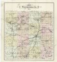
| Description: | This map shows railroads, churches, schools, cemeteries, rivers, lakes, and some rural property owners. |
If you didn't find the material you searched for, our Library Reference Staff can help.
Call our reference desk at 608-264-6535 or email us at: