Filter: Categories of Wisconsin Historical Images
Filter: FORMAT_TYPE of drawings
Filter: Subject of water
Filter: Categories of Wisconsin Historical Images
Filter: FORMAT_TYPE of drawings
Filter: Subject of water
| Date: | 12 1938 |
|---|---|
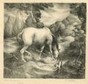
| Description: | Horse drinking from a stream with a small dog nearby. |

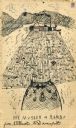
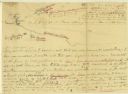
| Date: | 1833 |
|---|---|
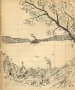
| Description: | Published in James Smith Buck's, "Pioneer History of Milwaukee". Lake Michigan is on the right, with three rivers that combine at different points and reac... |

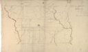
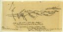
| Date: | 1833 |
|---|---|
| Description: | Drawing on a faint grid with Lake Michigan on the right, and the rivers on the left. Labeled is an Indian Village, J. Veiu, S. Juneau, and P. Juneau. Alo... |
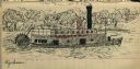
| Date: | 1903 |
|---|---|
| Description: | Drawing of steamboat in the distance on a river (possibly the Wisconsin River). |
| Date: | 1903 |
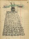
|---|---|
| Description: | Lock and dam system on a canal along the Mississippi River. |
| Date: | 1903 |
|---|---|
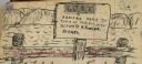
| Description: | Sign posted on a fence announcing a lost camera near the town of Prairie du Sac and requesting its return to Herbert Fowler. |
| Date: | 1903 |
|---|---|
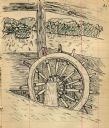
| Description: | Drawing of a ship's steering wheel with river and trees visible through the cabin. |
| Date: | 1903 |
|---|---|
| Description: | Drawing of a steamboat pulling a raft of cut boards. |
| Date: | 1903 |
|---|---|
| Description: | Drawing of the steamboat Weyerhauser on the Mississippi River. |
| Date: | 1903 |
|---|---|
| Description: | Drawing of the "Rambo" and "Musser" transporting a log raft on the Mississippi River. |
| Date: | 1869 |
|---|---|
| Description: | Hand-drawn map of York County, South Carolina. |
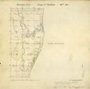
| Date: | 03 31 1852 |
|---|---|
| Description: | Surveyors map showing the Root River and Lake Michigan. |
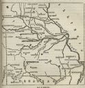
| Date: | |
|---|---|
| Description: | Map of Missouri with major cities, rivers, and railroads marked. |
| Date: | |
|---|---|
| Description: | A hand-drawn map of the Boone camps on the Kentucky River. |

| Date: | 11 26 1883 |
|---|---|
| Description: | A hand-drawn map of the Clinch and Powell's Valleys, including the Cumberland Mountains, Powell's Mountains and Clinch Mountains. |
| Date: | 07 08 1774 |
|---|---|
| Description: | A hand-drawn map showing forts along the Clinch River. |

| Date: | |
|---|---|
| Description: | A hand-drawn map of the Guyandotte River. |

| Date: | |
|---|---|
| Description: | A hand-drawn map of Indian boundary lines in southwest Virginia. It also includes the Duck River and the Elk River. |
If you didn't find the material you searched for, our Library Reference Staff can help.
Call our reference desk at 608-264-6535 or email us at: