 Filter: Categories of Wisconsin Historical Images
Filter: FORMAT_TYPE of drawings
Filter: Subject of water
Filter: Subject of human settlements
Filter: Categories of Wisconsin Historical Images
Filter: FORMAT_TYPE of drawings
Filter: Subject of water
Filter: Subject of human settlements
| Date: | 1873 |
|---|---|
| Description: | This map is pen-and-ink on cloth and shows lot numbers, block letters, streets, West Wis. Railway, Hudson City Mills, and Lake St. Croix. Also included are... |

| Date: | 1881 |
|---|---|
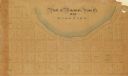
| Description: | This map is pen and ink on paper and shows part of the city of Menasha, local streets, Dendo Island, part of Lake Winnebago, and part of Little Lake Butte ... |
| Date: | |
|---|---|
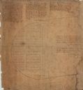
| Description: | This plat map is pen, pencil, and watercolor on paper and shows numbered blocks and lots, local streets, section lines, the public square, Mill pond, and l... |

| Date: | 1910 |
|---|---|
| Description: | This ink on paper blue line print base map consists of eight separate pieces and shows city limits, The Milwaukee Electric Railroad & Light Company lines, ... |

| Date: | 07 21 1835 |
|---|---|
| Description: | This map is ink and watercolor on tracing paper and shows township lines surveyed by Mullett and Brink, subdivision lines surveyed by A.G. Ellis, and part ... |

| Date: | 12 1886 |
|---|---|
| Description: | This map is ink and pen on tracing cloth and shows land ownership by name, canals, local streets, section lines, and original low water lines in blue. The ... |

| Date: | 1948 |
|---|---|
| Description: | This map is ink on tracing paper and shows acreages, wards, streets, rivers, and Lake Michigan. Also included are editorial notes in pencil. |

| Date: | 1836 |
|---|---|
| Description: | This map is ink on tracing paper and shows block numbers, streets, lot numbers of block no. 6, and a public square in Newburgh, a paper city (a city planne... |

| Date: | 1900 |
|---|---|
| Description: | This photocopied map shows private claim owners, buildings, and land use in 1818. Insets show Fort Howard and the caption reads: "A view of the Fox River ... |

| Date: | 1862 |
|---|---|
| Description: | This map shows landownership on a military reserve, private claims, buildings (including Fort Howard and U.S. sawmill), swamps, public barns and fields, an... |

| Date: | |
|---|---|
| Description: | A plat map drawn in blue and red ink of township No. 43 North of Range No. 4 East of 4th Meridian. |
| Date: | |
|---|---|
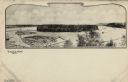
| Description: | Black and white illustration of Half Moon Lake with log jams and an island. Caption reads: "Half Moon Lake and Island, Eau Claire, Wis." |
| Date: | 1948 |
|---|---|
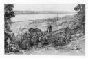
| Description: | A pencil drawing of two men descending a bluff with oxen and a wagon to Winona, Minnesota. There is a church in the town below and the Mississippi River is... |

| Date: | 1875 |
|---|---|
| Description: | The City of Fort Howard, Brown County, Wisconsin. Compiled from the records and drawn by F.E. Predergast, of De Pere. |

| Date: | 1857 |
|---|---|
| Description: | Green Lake County Abstract plat map, T. 14 N, R. 11 E. |

| Date: | 1857 |
|---|---|
| Description: | Green Lake County abstract plat map, T. 16 N, R. 11 E. |

| Date: | 1857 |
|---|---|
| Description: | Green Lake County abstract plat map, T. 17 N, R. 11 E. |

| Date: | 1857 |
|---|---|
| Description: | Green Lake County plat map, T. 15 N., R. 12 E. |

| Date: | 1857 |
|---|---|
| Description: | Green Lake County plat map, T. 14 N, R. 12 E. |
If you didn't find the material you searched for, our Library Reference Staff can help.
Call our reference desk at 608-264-6535 or email us at:
