 Filter: Categories of Wisconsin Historical Images
Filter: County of Walworth
Filter: Year of 1900-1999
Filter: Type of Map or Atlas
Filter: Categories of Wisconsin Historical Images
Filter: County of Walworth
Filter: Year of 1900-1999
Filter: Type of Map or Atlas

| Date: | 1916 |
|---|---|
| Description: | Southeastern Wisconsin which lies east of Whitewater and south of Port Washington. |

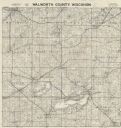
| Date: | 1900 |
|---|---|
| Description: | This 1900 map of Walworth County, Wisconsin, shows the township and range grid, towns, sections, landownership and acreages, rural residences, cities and v... |

| Date: | 01 01 1935 |
|---|---|
| Description: | This 1935 map of Walworth County, Wisconsin, shows the township and range grid, towns, sections, cities and villages, highways and roads, railroads, school... |

| Date: | 1907 |
|---|---|
| Description: | Shows post offices, railroads, country clubs, and land ownership by name. |

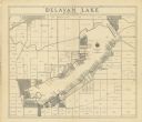
| Date: | 1930 |
|---|---|
| Description: | Shows roads, fire stations, golf course, and accommodations around Delavan Lake. "The drive around the lake is divided into zones from 0 to 900 as shown. P... |

| Date: | 1910 |
|---|---|
| Description: | Map shows routes, post offices, houses, churches, roads, and schools."June 1, 1910. E.G."Blue line print."Walworth Co., Wis. 451" -- bottom margin. |

| Date: | 1939 |
|---|---|
| Description: | This map of Walworth County, Wisconsin, shows the township and range grid, sections, cities and town, and lakes and streams in the county. It lacks the key... |

| Date: | 1939 |
|---|---|
| Description: | This map of Walworth County, Wisconsin, shows the lakes and streams flowing into the Fox River and the lakes and streams flowing into the Rock River. The d... |
| Date: | 1956 |
|---|---|
| Description: | Map shows townships and sections, landownership and acreages, roads, schools, churches, and cemeteries. |
| Date: | 1930 |
|---|---|
| Description: | Shows land ownership by name, roads, and highways. Includes manuscript annotations. |

| Date: | 1966 |
|---|---|
| Description: | This 1966 map shows topography, roads, highways, golf courses, government buildings, and businesses around Delavan Lake in Walworth County, Wisconsin. Incl... |

| Date: | 1900 |
|---|---|
| Description: | Pen and pencil on tracing paper. Shows landownership by name, local streets, local businesses, mill pond, creek, and proposed railroad. |
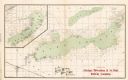
| Date: | 1902 |
|---|---|
| Description: | A map of Lake Geneva and Lake Delavan, also including Lake Como. |
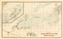
| Date: | 1907 |
|---|---|
| Description: | A map of Lake Geneva and Lake Delavan, including Lake Como. |

| Date: | 1959 |
|---|---|
| Description: | This map of Lake Geneva has relief shown by contours and water depths shown by isolines. The map includes an index of schools, churches, public services, i... |

| Date: | 1930 |
|---|---|
| Description: | This map has relief shown pictorially and shows plat of the city, block numbers, land ownership by name, local streets, railroads, mill pond, and part of G... |

| Date: | 1966 |
|---|---|
| Description: | The map shows streets, wells, school land, parks, cemeteries, railroads, and the Delbrook Golf Course. The bottom of the map reads: "January 11, 1962 May 2... |

| Date: | 1965 |
|---|---|
| Description: | This map shows proposed streets, arterial and collector streets, lot numbers and dimensions, parks, the disposal plant, a ball park, and school property. T... |
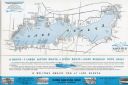
| Date: | 1939 |
|---|---|
| Description: | A brochure for the Wisconsin Transportation Co. includes a map of Lake Geneva with towns and shoreline property owners identified. Black Point, on the sout... |

| Date: | 1962 |
|---|---|
| Description: | This blue print map shows 5 zoning districts, as well as lot and block numbers and dimensions, public land, streets, and Mill Pond. The zones are: "Single ... |
If you didn't find the material you searched for, our Library Reference Staff can help.
Call our reference desk at 608-264-6535 or email us at: