Map or Atlas
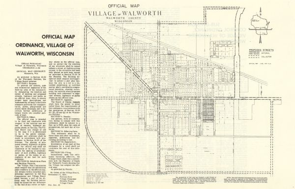
Official Map, Village of Walworth, Walworth County, Wisconsin

| This map shows proposed streets, arterial and collector streets, lot numbers and dimensions, parks, the disposal plant, a ball park, and school property. The front of the map includes text on official map ordinance and the reverse includes text on sub-division control ordinance. The bottom of the map reads: "By order of the Village Board, November 17, 1965. Herman Suhr Village President Beverly Finley Village Clerk Pub. Nov. 25." |
| Image ID: | 112941 |
|---|---|
| Creation Date: | 1965 |
| Creator Name: | Unknown |
| City: | Walworth |
| County: | Walworth |
| State: | Wisconsin |
| Collection Name: | Map Collection |
| Genre: | Map or Atlas |
| Original Format Type: | prints, photomechanical |
| Original Format Number: | D GX9029 W81 M |
| Original Dimensions: | 26 x 30 cm., on sheet 29 x 45 cm. |
| "The preparation of this map was financed in part through an Urban Planning Grant from the Housing and Home Finance Agency ... and was executed under a contract with the State of Wisconsin, Department of Resource Development." |
| Cities and towns |
| Parks |
| Railroads |
| Streets |
| Athletic fields |
| Schools |
| This image is issued by the Wisconsin Historical Society. Use of the image requires written permission from the staff of the Collections Division. It may not be sold or redistributed, copied or distributed as a photograph, electronic file, or any other media. The image should not be significantly altered through conventional or electronic means. Images altered beyond standard cropping and resizing require further negotiation with a staff member. The user is responsible for all issues of copyright. Please Credit: Wisconsin Historical Society. |
| Location: | Wisconsin Historical Society Archives, 4th Floor, Madison, Wisconsin |
|---|
