 Filter: Categories of Wisconsin Historical Images
Filter: County of Sauk
Filter: Subject of bird's-eye views
Filter: Categories of Wisconsin Historical Images
Filter: County of Sauk
Filter: Subject of bird's-eye views

| Date: | 1870 |
|---|---|
| Description: | Baraboo was first settled around 1838, and by 1870 it had become the county seat and the thriving village illustrated here. This birds eye drawing depicts ... |

| Date: | 1870 |
|---|---|
| Description: | Bird's-eye map of Prairie du Sac. |

| Date: | 1874 |
|---|---|
| Description: | Bird's-eye map of Reedsburg, on the Baraboo River. |

| Date: | 1870 |
|---|---|
| Description: | Sauk City is the oldest incorporated village in Wisconsin (incorporated in 1854) and also has the oldest organized volunteer fire department in the state, ... |

| Date: | 1883 |
|---|---|
| Description: | Bird's-eye map of Prairie du Sac, Wisconsin with an inset of Clifton. |

| Date: | 1883 |
|---|---|
| Description: | Bird's-eye map of Sauk City. |

| Date: | 1886 |
|---|---|
| Description: | Bird's-eye map of Baraboo with inset of Devil's Lake, the south and east sides of the commercial square, the First National Bank, and the Warren House hote... |

| Date: | 1950 |
|---|---|
| Description: | Text on front reads: "Horseshoe Curve At Rock Springs, Wis." A road and a railroad track, with bridges over the Baraboo River, make a double curve in an el... |
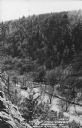
| Date: | 1950 |
|---|---|
| Description: | Text on front reads: "The Old Mill Stream in the Narrows at Rock Springs, Wis." A road and the Narrows Creek run next to each other in an elevated view of ... |
If you didn't find the material you searched for, our Library Reference Staff can help.
Call our reference desk at 608-264-6535 or email us at: