| Date: | 1862 |
|---|---|
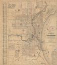
| Description: | Drawn the second year of the Civil War, this 1862 map of Milwaukee shows post offices, light houses, beacon lights, county buildings, elevator warehouses, ... |

| Date: | 1861 |
|---|---|
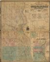
| Description: | Map with labelled block and lot numbers, owners of large property parcels, city wards, railroads, and streets. Population from 1835 to 1860 listed below ti... |

| Date: | 1863 |
|---|---|
| Description: | Includes index to public buildings, churches, schools. Inset: Glidden & Lockwood’s addition. Gives names of some property owners. |

| Date: | 1869 |
|---|---|
| Description: | This map was engraved from original drawings and surveys taken by Louis Lipman. Includes Milwaukee street directory on the left hand side. Bottom right cor... |

| Date: | 1869 |
|---|---|
| Description: | Map shows townships and sections, landownership and acreages, buildings, and marshes. The map includes insets of Franklin, Hales Corners, Bay View, Oak Cre... |

| Date: | 1860 |
|---|---|
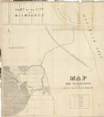
| Description: | Map shows meadows, forests, buildings, railroad, and lots south of part of the city of Milwaukee. Relief shown by hachures. Includes list of lot acreages. |

| Date: | 1868 |
|---|---|
| Description: | This map shows lot and block numbers, some property ownership, wards, roads, and railroads. An inset map shows the Glidden & Lockwood’s addition. There are... |

| Date: | 1869 |
|---|---|
| Description: | This map shows lot and block numbers, some property ownership, wards, roads, and railroads and includes inset map of Glidden & Lockwood’s addition. There a... |

| Date: | 10 13 1864 |
|---|---|
| Description: | This map shows the shore line of Oct. 14 1864, city limits of water lots, and the elevation of water in Lake Michigan. Depths are shown by soundings. |
If you didn't find the material you searched for, our Library Reference Staff can help.
Call our reference desk at 608-264-6535 or email us at: