 Filter: Categories of Wisconsin Historical Images
Filter: Creator Name of Wisconsin. Conservation Department.
Filter: Year of 1900-1999
Filter: Categories of Wisconsin Historical Images
Filter: Creator Name of Wisconsin. Conservation Department.
Filter: Year of 1900-1999

| Date: | 1946 |
|---|---|
| Description: | View of the Wisconsin State Capitol building and the surrounding area from Lake Monona. |

| Date: | 1937 |
|---|---|
| Description: | Picnic and play area at Interstate Park, near the St. Croix River. Two girls swing as an adult male sits on a picnic table in the foreground with a child o... |

| Date: | 1942 |
|---|---|
| Description: | Warden Kramer and his assistant in a boat removing an illegal snag line from the Wolf River. |

| Date: | 1942 |
|---|---|
| Description: | Warden Kramer and an assistant hold up confiscated sturgeon caught with illegal snag lines. |

| Date: | 09 25 1937 |
|---|---|
| Description: | Governor Philip Fox La Follette (center) together with Governors Horner (Illinois) and Kraschel (Iowa) pose in front of the fish they caught during a fishi... |

| Date: | 09 25 1937 |
|---|---|
| Description: | Governor Philip La Follette (Wisconsin) and Governor Henry Horner (Illinois) enjoy a laugh in the boat during a fishing trip. |

| Date: | 04 1965 |
|---|---|
| Description: | Governor Warren Knowles holding a fishing pole and a fly. He is seated at a table covered in fishing tackle and additional fishing gear hangs on a rack at ... |

| Date: | 1958 |
|---|---|
| Description: | Includes images of Flambeau River State Forest and a description of, canoeing and recreational activities in, and general park and forest information about... |
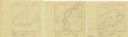
| Date: | 1939 |
|---|---|
| Description: | A survey map of Island Lake in Bayfield County, Wisconsin, Chain Lake in Rusk and Chippewa counties, and Manson Lake in Oneida County. The maps show the de... |

| Date: | 04 1932 |
|---|---|
| Description: | This Wisconsin Conservation Department map shows federal, state, and county forest areas, the relative proportion of land owned by each agency, and state p... |

| Date: | 06 1934 |
|---|---|
| Description: | This Wisconsin Conservation Department map shows national, state, and county forests both approved and pending, as well as Indian reservations in Wisconsin... |

| Date: | 05 1935 |
|---|---|
| Description: | This Wisconsin Conservation Department map shows the locations of state forests, state nurseries, state parks, roadside parks, prison camps, and lookout to... |

| Date: | 1936 |
|---|---|
| Description: | This 1936 Wisconsin Conservation Dept. map shows the locations of state forestry Civilian Conservation Corps (CCC) camps, closed state forestry CCC camps, ... |

| Date: | 1937 |
|---|---|
| Description: | This map shows the Wisconsin Conservation Department forest protection divisions and the locations of state forests, national forests, Indian reservations,... |

| Date: | 1937 |
|---|---|
| Description: | This Wisconsin Conservation Department map shows the locations of game refuges, fish hatcheries, canning factories, fish camps, and fish refuges in the sta... |

| Date: | 1937 |
|---|---|
| Description: | This Wisconsin Conservation Department map shows the locations of state forests, national forests, county forests, state nurseries, Indian reservations, st... |

| Date: | 05 01 1938 |
|---|---|
| Description: | This map shows the locations of Wisconsin Conservation Department forest protection districts and cooperative areas, state forests, national forests, India... |

| Date: | 1933 |
|---|---|
| Description: | This 1933 Wisconsin Conservation Dept. map shows roads, railroads, trails, lakes and streams, and the Trout Lake Game Refuge in Northern State Forest (whic... |

| Date: | 1956 |
|---|---|
| Description: | This map shows the types of upland and lowland forest vegetation on Stockton Island, one of the Apostle Islands in Lake Superior. |

| Date: | 1952 |
|---|---|
| Description: | This Wisconsin Conservation Dept. map shows sections, roads, rivers, and lakes in the Town of Cloverland, Vilas County, Wisconsin as of February, 1952. It ... |
If you didn't find the material you searched for, our Library Reference Staff can help.
Call our reference desk at 608-264-6535 or email us at: